
ResourcesIdentification of Important Habitats in Coastal New HampshireChapter 7. EelgrassEelgrass (Zostera marina)is a submergent vascular plant typically
growing in subtidal inshore waters along the middle and northern Atlantic
seaboard. It requires a muddy to sandy sediment, which is usually associated
with moderate water currents and limited wave action. Eelgrass beds serve
as structure and cover for marine and estuarine vertebrates and invertebrates,
and as a primary producer of organic matter. Short (1992) documented the
value of eelgrass to the Great Bay ecosystem. DATA SOURCES: Dr. Fred Short (Jackson Estuarine Research
Laboratory) provided us with a coverage of eelgrass beds in Great Bay
based on 1990 photography, and a hard copy map of additional areas in
the upper Piscataqua River mapped from a 1995 field survey. We obtained
a coverage of eelgrass in the Maine side of the Piscataqua River produced
by Seth Barker (Maine DMR), based on true color 1992 to 1995 1:12,000
aerial photos. We also digitized a map depicting eelgrass beds in Great
Bay, Little Bay, and the Piscataqua River from 1980-1981 surveys by New
Hampshire Fish and Game. The F. Short 1995 map and the Fish and Game maps
were scanned, registered, and clipped to avoid overlap with uplands/intertidal
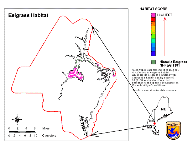
wetlands and areas over 30' deep. MAPPING OF HABITATS: Our eelgrass coverage was created
by combining data from the above sources, updating or replacing older
polygons representing specific eelgrass beds with the most accurate sources.
Most of the polygons from the oldest surveys were matched with and replaced
by polygons from the other coverages. The 1980-1981 survey mapped extensive
eelgrass beds in Little Bay; these beds have been absent or greatly reduced
in recent years (F. Short, pers. comm.), and so we did not regard them
as currently suitable habitat. They were retained for reference in an
intermediate coverage. The final habitat coverage included all polygons
from the F. Short 1990 coverage and the S. Barker coverage, and polygons
from the F. Short 1995 map which were not represented in either of those
two coverages. It should be noted that other parts of coastal New Hampshire
were not surveyed and may have eelgrass; these include Little Harbor,
Portsmouth Harbor, and Back Bay. The polygon coverage was converted to grid-cell format. All cells were
assigned a habitat quality score of 10, or optimal habitat, since the
actual presence of the species demonstrated the suitability of conditions
(Figure of Eelgrass). |