
Editor's Notes
Giving voice to the Mersey
Trip retraces an old canoe route to find much has changed
Printer Friendly Page
We are retracing the first documented canoe trip in Nova Scotia taken in 1686 by a Frenchman
named Jacques De Meulles, the Intendant of New France. As part of France's settlement plan, De
Meulles sailed from Quebec to this area where the Bay of Fundy meets the Annapolis River. From
here he decided it was “essential” to make the voyage by canoe to the Atlantic. He assembled a
crew of eight men, including two Mic'kmaq Indians who would take the explorers coast to coast via
routes that had been used for centuries by native peoples.
“This trip may be considered as one of the hardest one could make in a lifetime,” he writes
in a journal, “for in addition to all the difficulty we had in carrying all our food and belongings
through the woods where there were no trails…we also found some very dangerous rapids, full of great
boulders and rocks, and of extraordinary length.”
Our main channel to the Atlantic is the Mersey River system, the largest of Nova Scotia's 44
primary watersheds. I am interested mostly in recording first hand the changes in the watershed
since De Meulles' time. This much I know: the river De Meulles traversed, the Mersey, rises on
the south side of South Mountain in a series of lakes, making its way downward through mixed
hardwood forests heading to the coast. Historically, the Mersey was a combination of meadows,
lakes, pools, runs and drops and contained the largest population of Atlantic salmon in the
Maritimes. Nowadays, the upper Mersey contains two small dams and sporadic clear cuts, yet it
remains dynamic and productive, particularly around the periphery and interior of Kejimkujik
Park National Park.
The lower Mersey is a different story. Flooded during the late 20s to
create a massive reservoir, Lake Rossignol, the river is harnessed by six hydroelectric dams
until it becomes tidal again near Liverpool Harbour. Only the lower three dams provide fish
passage. One reason, I'm told, is to contain the small-mouthed bass and keep the intruder from
getting into Lake Rossignol and the park's waterways where it can do severe damage to native fish
and other species, including the endangered Blandings turtle and eastern ribbonsnake.
Clear cuts and lost trails
We spend our first night on Grand Lake, De Meulles' actual point of departure, camped on a
spit amid cottage country. Gale force winds and rain pummel us all night long. The wet tents and
gear have added several pounds to our load, as we set off the next morning to headwaters of the
Mersey River. After we reach another long, uncertain portage we cross over an old stone dam and
enter what Jim Todd, one of the trips organizers, has coined “The Missing Link.” He has skied and
snowshoed the area during the winter, marking off a trail running through a forest near a stunning
waterfall. But by the time we reach his portage, the forest has been clear cut, leaving a precarious
thicket of “slash” debris behind and erasing all signs of a trail. It is a greedy cut, a surreal
and silent wound, hidden from drive-by
view like a big, dark secret.
Still damp from the night before, we dry out at the Milford Community Hall offered to us by
local residents. They make us coffee, muffins and shortbreads. After a hot meal, Jean McIsaac, a
Mic'kmaq, drums and sings traditional songs. She offers us a gift of an eagle feather to give us
strength for our journey. While De Meulles may have been the first European to travel this course,
he could not have done it without his Mic'kmaq guides. This excursion is as much about their culture
as it is about 17th century explorers. Last summer archaeologists discovered hundreds of Mic'kmaq
artifacts around 109 ancient campsites along the Mersey River, some dating back 8,000 years.
Life amid the whitewater
All day long we explore the rapids. Riding the whitewater, eddying into coves, practicing
figure eights in the rushing currents. One canoeist gets knocked from his stern after encountering
a surprise sweep of downed trees near the Mersey Bridge. He summersaults beneath his canoe and
bobs to the surface, his feet facing downstream, much to everyone's great relief.
While others go ahead to scout out conditions downstream, another canoeist pulls me to the
riverbank where a jellied glob of frogspawn swimming with tadpoles rests on a mossy rock. I
immediately think of Seamus Heaney's poem,” Death of a Naturalist,” where he writes: “There
were dragonflies and spotted butterflies, but best of all was the warm thick slobber of frogspawn
that grew like clotted water in the shade of the banks.”
Coursing down this racing river feels at times like I'm watching the blur of the landscape
through the window of a train. I look for the obvious markers of the watersheds' vitality.
In one day I record sightings of osprey, beaver lodges, eagle, kingfisher, warblers, Canada geese,
mallards and blue heron. The season is advancing swiftest along the water's edge where red
maples steal the show with their feathery crimson buds. In the bogs I find sprouts of pitcher
plants. I fall asleep to the deep hoots of a great horned owl.
What De Meulles did not see
I ask Gary Corbett, the fish and wildlife biologist at Kejimkujik National Park, “Just how healthy is
the Mersey system?” His reply: “When you get above the dams, above Rossignol it's quite healthy.
But when you get down to Rossignol and below the situation is not good. It's an eerie place. It
appears to be dead or almost dying. It's not a very productive system.”
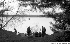
Out on the water early, we make it to the north side of Rossignol by mid-day. First we navigate
around a maze of tree stumps until we break into a Serengeti of blue waters. We pass slivers of
islands crowded with driftwood. Rossignol is full of islands, or rather the hilly banks of lakes
that have been flooded to create the reservoir, which spans about 12 miles at its widest. In the
fall, the bogs here are bursting with cranberries.
I'm already sensing a psychological shift in the waterscape. The lake looks and feels like a
drowned river. Winds and fluctuating water levels make Rossignol an unpredictable paddle, and
we've allowed ourselves two days to cross. A storm is tracking up the
Atlantic and reports from a weather radio call for gale force winds and heavy rain starting
late tomorrow.
We sit out the storm for the next 48 hours. Despite the rains, generation
downstream has dropped the water level nearly two feet within a day. The abundance of wildlife
so apparent upriver is absent here, apart from a transient flock of finches. While it's well
documented that the salmon are nearly gone, I wonder about the eels. I'm told they slither
along the banks to get passed the multiple dams, but that's only half the story. “Their
population is depressed and the main impact on has got to be those dams,” Gary Corbett tells
me later. “The elvers [juvenile eels] are coming over the land, but not all of them are
getting through. But the adult eels going to sea have to go through all those turbines and
probably a good percent of those eels don't survive.”
Here on the lower Mersey it is not a hopeful picture, yet there is still hope for the
upper river. Corbett and his colleagues are working on a management plan for Kejimkujik that
has engaged conservation organizations, forestry and power companies. “The main thrust is to
develop a stewardship plan, to try to improve the situation,” he says.
On the way home to Annapolis we sit in a heated van and compare notes with De Meulles' 300
year old account. Drifting off I start thinking about the Kennebec River in Maine, how soon it
began to recover after the downing of the Edward's Dam. I wish the same for the Mersey.
Perhaps three hundred years from now, after we have learned some sobering lessons, other
canoeists will travel the route of Mic'kmaq and De Meulles and hear the river running in clear
cadences from the top of South Mountain to the Atlantic, its waters teaming with sea run fish,
between banks growing dense again, with hemlock, maple, oak and spruce.
Special thanks to Dave Dagley and Louis Wamboldt of the Queens County Fish & Game Association for
sharing their insights about the Mersey River watershed.
- Andi Rierden
©
2005 The Gulf of Maine Times
 THIS EARLY APRIL morning the sky is flooded with clouds, spring is slowly unfolding, the rain
pulling back for now as we pull our canoes away from the Queen's Wharf in Annapolis Royal,
Nova Scotia. A bald eagle surveying the mud flats, takes flight at our approach. Paddling into a
southerly wind against the outgoing tide, I watch as it fades into the shelter of a white birch
stand not far from where I live. Up ahead, two Mic'kmaq guides in a birch bark canoe escort our
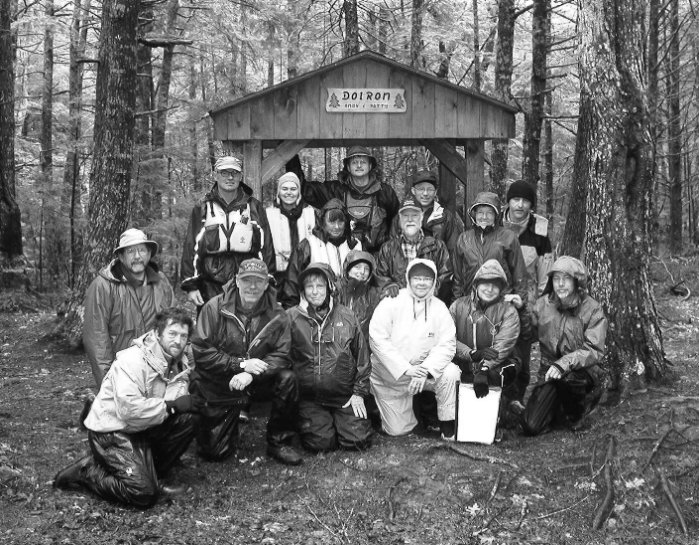
team of 18 paddlers well along the tidal river before they wish us well and turn back.
THIS EARLY APRIL morning the sky is flooded with clouds, spring is slowly unfolding, the rain
pulling back for now as we pull our canoes away from the Queen's Wharf in Annapolis Royal,
Nova Scotia. A bald eagle surveying the mud flats, takes flight at our approach. Paddling into a
southerly wind against the outgoing tide, I watch as it fades into the shelter of a white birch
stand not far from where I live. Up ahead, two Mic'kmaq guides in a birch bark canoe escort our
team of 18 paddlers well along the tidal river before they wish us well and turn back.
 We spend the night at Low Landing and are packed up and on the water by 6 a.m. After a hard,
rocky paddle through shifting winds, we reach the south side and the first dam
by noon. Then across dam two, three and four where I discover the first operating fish ladder.
After 12 hours, we come to a Boy Scout camp on an island, six kilometers [3.7 miles] from Liverpool
Harbour, our final destination.
We spend the night at Low Landing and are packed up and on the water by 6 a.m. After a hard,
rocky paddle through shifting winds, we reach the south side and the first dam
by noon. Then across dam two, three and four where I discover the first operating fish ladder.
After 12 hours, we come to a Boy Scout camp on an island, six kilometers [3.7 miles] from Liverpool
Harbour, our final destination.