Plans underway to restore Maine tidal river
Printer Friendly Page
By Lee Bumsted
MAPMAKERS don’t often get the chance to redraw natural features on maps of well-known areas. But after the earthen embankment of Sherman Lake in Newcastle, Maine, gave way last October, they were given such an opportunity. The name “Sherman Lake” needs to be pulled from those maps too. “Upper Marsh River,” anyone? What had been a body of fresh water for 71 years is returning to some semblance of what it once was, the upper end of the tidal Marsh River. A section of U.S. Route 1 runs over the embankment, so after heavy rains caused the washout, the Maine Department of Transportation (MaineDOT) made a short-term repair, stabilizing the roadway with riprap. With the barrier partially removed, a tidal flow of salt water resumed. Because the flow is restricted, the area's habitat is presently neither fully freshwater nor fully saltwater. In January, officials decided against rebuilding the dam in favor of restoring salt marsh habitat to the area. With the temporary repair in place, there is time to gather the information needed to design a permanent solution. MaineDOT will be cooperating with agencies such as the U.S. Fish & Wildlife Service, the National Oceanic and Atmospheric Administration and the Maine State Planning Office. These groups will share data and ideas on the restoration. Charles Hebson, the chief hydrologist for MaineDOT, says the department needs to encase the roadway's steel bridge piers with concrete to protect them from salt water and to provide structural support. He foresees a design that creates a second channel under the roadway to enhance tidal flow. This summer, MaineDOT will be gathering hydrologic data on the site's tide levels and analyzing new topographic data. By the time the planning and design activity is completed and construction funding is secured, repair work could begin in 2007. Hebson estimates the repair costs will fall in the range of $400,000 to $500,000. He is hopeful that the project will qualify for Federal Highway Administration funds, which would cover 80 percent of total construction costs. Hebson is looking forward to MaineDOT partnering with agencies with salt marsh restoration expertise. “It’s a constructive, cooperative approach to developing a good project,” he says. “There is no reason why we can’t have a good transportation project that is also good for the marsh.” He believes the permitting process for the repair work can go more smoothly if MaineDOT and the federal agencies that will be reviewing the permit requests work together early in the planning process. Sandra Lary, a fish and wildlife biologist with the U.S. Fish and Wildlife Service/Gulf of Maine Coastal Program, is acting as a project design and fundraising advisor.
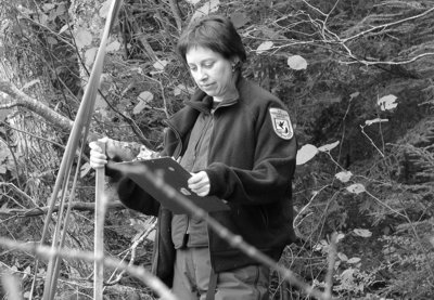
Sandra Lary, senior fish and wildlife biologist with the U.S. Fish & Wildlife Service's Gulf of Maine Coastal Program, is excited about helping Sherman Lake return to its original state. "Any time you go from a system that has been dammed, to restoring tidal flow that will bring back salt marsh habitat, intertidal mud-flat habitat, shorebird habitat and estuarine fish habitat, it's a great opportunity," she says. "This can be a beautiful, very productive area, that can be enjoyed by locals and people travelling in Maine, as it is right on Route 1." Lary will be offering planning assistance on the restoration project. This will include advising on what data should be gathered pre- and post-restoration, advising on the project design and assisting with fundraising. She estimates the cost of a basic salt marsh monitoring project at $30,000 to $50,000. This would examine environmental parameters such as salinity and what vegetation is present. Once tidal flow is completely restored, salt marsh vegetation will likely reestablish itself, with no need for planting, according to Lary. "A lot of these salt marsh restoration projects don't require any additional work once you address the manmade modifications," she says. "They're very quick to recover." Any gains by planting salt marsh vegetation could be offset by the human disturbance needed to plant it. There are some concerns that the longer it takes to restore full tidal flow to the marsh, the greater the likelihood that invasive plants such as phragmites may take hold and then need to be removed. A MaineDOT-maintained rest area with plentiful parking is adjacent to the site. Local residents are hopeful that recreational access from the rest area can be restored as well. According to Hebson, that is under consideration as part of the project. Sherman Lake was popular for fishing and canoeing, and the Upper Marsh River can offer these same opportunities. Visitors will want to watch the tide and check those newly drawn charts and maps.
© 2006 The Gulf of Maine Times

PHOTO: USFWS