| Committing to Change
Gulf of Maine Summit Printer friendly format
October 2004, St. Andrews, New Brunswick
By Andi Rierden, Editor
On the eve of the Gulf of Maine Summit held at the end of October, Jonathan Tourtellot, the director of sustainable tourism at the National Geographic Society, took the stage and presented his audience with several innovative challenges. One was to establish the “first international world heritage marine cultural landscape” in the Gulf of Maine. He suggested Passamaquoddy Bay. Another was to create map guides and trails signposted from Massachusetts to Nova Scotia with the emphasis on what Tourtellot has coined, “geotourism,” tourism that “sustains or enhances the geographical character of a place—its environment, culture, aesthetics and heritage.”
The Gulf of Maine needs your help, Tourtellot said. “It’s time to push the agenda.”
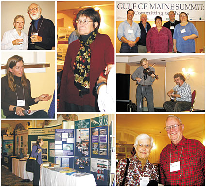 Clockwise from top left: Pam Person, GPAC and Steve Perrin, Friends of Taunton Bay; Susan Shaw, Marine Environmental Research Institute; Summit facilitators: l to r, Dana Morse, Maine Sea Grant, Ron Beard, UMaine Cooperative Extension; Patty King, Summit Coordinator; Paul Anderson, Maine Sea Grant and Jane Tims, NB Department of Environment and Local Government; Jeff McKeen (standing) and Doug Protsik of the Old Grey Goose; UNH Marine Docents Howard and Phyllis Crosby; UMaine student viewing exhibits; Sarah Kirn of South Portland, ME in session on land use.
Photos: Andi Rierden
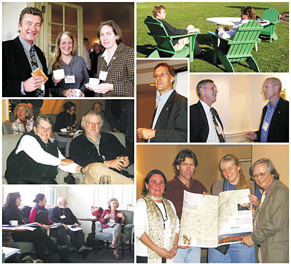
Clockwise from top left: Richard Langan, Cooperative Institute for Coastal and Estuarine Environmental Technology, Cathy Ramsdell, Friends of Casco Bay, Priscilla Brooks, Conservation Law Foundation; in lawn chairs: Aaron Frederick, Rippleffect and Bruce Smith, Seascape Kayak ; Rolland Smitten, National Marine Fisheries Service with Kim Hughes, NB Department of Environment and Local Government; (to their left) Jamey Smith, NB Salmon Growers Association; l to r, Theresa Torrent-Ellis, Maine Coastal Program, Bruce Smith, Seascape Kayak, Natalie Springuel, Maine Sea Grant and Jonathan Tourtellot, National Geographic Society holding “geotourism” map guide; participants in session on land use; Sue Hutchins and Dan Earle, Gulf of Maine Expedition. | | The message reverberated throughout the Summit. Whether the topic was tourism or toxins, the forum gave participants from a broad range of fields and backgrounds an opportunity to report on community forums and monitoring programs, share information on environmental issues in their neighborhoods and devise future actions to reduce or avoid dangers to the Gulf of Maine watershed.
And they rallied.
“People
have come here because they want to see changes,” said Steve
Perrin, president of Friends of Taunton Bay in Maine. “There’s
a sense of urgency in the air.”
The weeklong conference at the Fairmont Algonquin Hotel in St. Andrews, New Brunswick hosted by the Gulf of Maine Council (GOMC) and the Global Programme of Action Coalition for the Gulf of Maine (GPAC) drew more than 250 scientists, government and industry representatives, environmentalists and individual citizens from the region and beyond.
Many of those that attended had clear concerns. “I’m worried about water quality and how development is forcing out people who have lived on the coast for generations,” said Suzanne Heddrick of Nobleboro, Maine. “I just want to make certain the Gulf of Maine is healthy for my grandchildren.”
The centerpiece and guide for the Summit was an 81-page document,
Tides of Change Across The Gulf: An Environmental Report on the
Gulf of Maine and Bay of Fundy, [see Q & A, Page Eight].
The report was based on 12 forums and related events held throughout
the Gulf of Maine and organized by GPAC between May 2002 and December
2003. While the forums, which attracted 1,000 people, focused on
local watershed issues, another workshop began linking and coordinating
data between the region’s monitoring programs and devising
ways to improve reporting methods. In addition, scientists from
throughout the Gulf of Maine met earlier this year to establish
ecosystem “indicators” for the region.
What indicators indicate
One of the most promising approaches to documenting environmental changes is the use of indicators. Just as a blood pressure or cholesterol measurement can give us clues about the state of our health, environmental indicators give us a picture of the state of our ecosystems. Mussels and other shellfish, for example, are excellent indicators of chemical pollution because of their ability to accumulate chemicals in their tissues. The spread of an invasive plant species such as Phragmites may be an indicator of degraded water conditions from expanding development along the fringes of a wetland.
In the Gulf of Maine, dozens of organizations and individuals routinely collect and analyze data using indicator principles to measure the water quality of a lake, river or estuary. What is lacking, said conference attendees, is a cohesive plan to coordinate the data Gulf-wide along with guidelines to determine its reliability. Also lacking is a plan to communicate these findings to specific audiences, such as resource managers, politicians or the general public.
Down to business
Charged with creating a suite of indicators for the issues outlined
in the Tides of Change report—land use, contaminants
and fisheries and aquaculture—participants went to work. They
spent the first day brainstorming, debating and educating each other
about issues close to home. In a session on land use, for example,
major concerns revolved around the break up of natural spaces from
new roads and houses, and the cultural divide between newcomers
and long-time residents.
“The first thing an urban person does is buy up a piece of property then flatten it down to the water just to get the view” often resulting in habitat destruction, said a forester from New Brunswick.
Many of the issues from each group overlapped. The paving over of rural landscapes for shopping malls, it was noted, also affects water quality and aquatic or wildlife habitat. “The problems around land use are so generic and pervasive,” said John Terry, founder of the Gulf of Maine Institute Without Walls, who has lived in Maine and in Nova Scotia. “The Gulf of Maine Council has opened up the whole discussion and takes us up the river. Everything that goes into the watershed goes downstream to the Gulf of Maine.”
|
By the end of the first day, participants like Dan Earle of Yarmouth, Nova Scotia, who worked in a contaminants group, called the session intense, and given the scope of the task, overwhelming.”The first couple of days here were relaxing, but this is murder,” he said.
Day two seemed to bring about a breakthrough, with participants continuing discussions about “next steps” in groups and at meals and coffee breaks. While some found the group sessions frustrating and the topics difficult to nail down, others appreciated the interchange. “It’s been a real education,” said Howard Crosby, a volunteer in the University of New Hampshire Marine Docents program.
Midway through the discussions, David Keeley, a Summit coordinator, urged participants to be patient. “Nobody here has all the answers,” he said. “We are clearly into the process.”
On the last day of the Summit, facilitators summarized the recommendations from each group. Paul Anderson, director of Maine Sea Grant, who led a session on contaminants, called the two-day process “a tough gig.” Recommendations included coordinating data throughout the Gulf, developing goals and objectives for the indicators, and publishing a “State of the Gulf” document as a report card on the Gulf of Maine’s health. Others suggested that the Gulf of Maine Council collaborate more with fisheries management and industry. In a panel discussion to closeout the Summit, Robert Varney, regional administrator of the New England office of the U.S. Environmental Protection Agency, said that public access to the data and financial support for researchers and non-government groups working on these issues is critical. He cautioned that “harmonizing the data” would be difficult because “scientist often have no idea what other scientists are up to.”
In the end, Dana Morse of Maine Sea Grant, summarized the overall sentiments of participants. “It’s important for this process to continue if for no other reason than to honor the hard work that was done at this Summit.”
Notes from all the sessions are online at www.gulfofmaine.org. Participants have been asked to review their contributions and add comments. A Gulf of Maine Summit report incorporating those comments will be available early next year.
A
proclamation and new reports
Other highlights of the Summit included the commitment by the governors and premiers in the region to sign a proclamation supporting the Gulf of Maine Council’s work in habitat restoration and protection, information distribution and promoting sustainable maritime activities. In addition, Rolland A. Schmitten, director of the Office of Habitat Conservation for the U.S. National Marine Fisheries Service, presented the Gulf of Maine Habitat Restoration Strategy: Restoring Coastal Habitat in the Gulf of Maine, compiled by the Gulf of Maine Council’s Restoration Subcommittee. The report calls for a regional approach to habitat restoration as many fish, birds and mammal species use the Gulf of Maine as part of their annual migration route. Profiles of riverine, intertidal, subtidal and deep water marine areas, and beach dune and island habitats are included. Also included is an overview of the 33 projects completed through a Gulf of Maine Council and National Oceanic and Atmospheric Administration habitat restoration partnership. Potential restoration or research-related projects include the Petticodiac River in New Brunswick and the Ipswich River in Massachusetts.
Susan Snow-Cotter, acting director of the Massachusetts Office of Coastal Zone Management, presented Gulf of Maine Mapping Initiative: A Framework for Ocean Management. The report details an ambitious project to map the entire Gulf of Maine. Ten percent of the area has already been mapped, Snow-Cotter said. “We have a full set of tools to map the offshore and increasingly coastal areas, where we’re really seeing the changes.” The University of New Hampshire Center for Coastal and Ocean Mapping has recently committed $1 million in ship time toward the project and the Geological Survey of Canada is interested in collaborating, she added. Both reports are available in PDF form at www.gulfofmaine.org. High resolution images of the ocean maps for educational or media purposes are also available online.
Other presenters at the Summit included Susan D. Shaw, founder and executive director of the Marine Environmental Research Institute in Blue Hill, Maine, Art McKay, the executive director of St. Croix Estuary Project in St. Stephen, New Brunswick and Jamey Smith of the New Brunswick Salmon Growers Association. |
| |
Gulf
of Maine Council at 15 years
“I recall being called naive thinking that something like this could happen,” says David Keeley, one of the seven founders of the Gulf of Maine Council. The idea that three New England states and two Canadian provinces, because of their economic and cultural ties to the Gulf, could best serve as its stewards, was hatched in a basement classroom on the campus of the University of Southern Maine in the mid-1980s. Keeley, who at the time was the head of the Maine Coastal Program, called the meeting and invited six like-minded individuals who also worked as resource managers at the state or provincial level: Peter Underwood and Art Longard (Nova Scotia), Richard Delaney (Massa-chusetts), Bill Ayer and Barry Jones (New Brunswick) and Dave Hartman (New Hampshire).
“We sat there for hours, shooting the breeze and just getting to know each other,” Keeley says. “We knew from the beginning that it would take years to build a solid foundation. We also knew that there would be times when we’d have less than complete engagement from states and provinces.”
As for devising a blueprint for a transboundary council, Keeley says, “We just made it up.” As for funding? “Nobody gave us a bag of cash and said get to it.”
Instead, each member from that initial meeting was charged with returning to his agency to sell the idea and ask for resources to launch it. Eventually, the commitments were sealed. The National Oceanic and Atmospheric Administration also provided seed money.
In December, 1989 the governors and premiers of Massachusetts, New Hampshire, Maine, New Brunswick and Nova Scotia signed an agreement creating the Gulf of Maine Council on the Marine Environment.
This fall’s Gulf of Maine Summit marked another milestone in the Council’s 15 year history, attracting more than 250 people from throughout the region. It followed on the announcement of three major ocean reports from Fisheries and Oceans Canada, the Pew Ocean Commission and the U.S. Commission on Ocean Governance. “What’s intriguing is this confluence of national effort that suggests we’re on a new track in regard to our oceans,” Keeley says.
And that’s good news.
While
the Council is not a regulatory body, nor given its limited
resources, “can it be all things to all people,”
these recent developments, Keeley adds, “puts us in
a good position to explore a whole range of options.”
—Andi Rierden
|
|
©
2004 The Gulf of Maine Times |