
ōTest Tubesö for Ecosystem-Based Management
By Peter H. Taylor
AT THE SAME TIME overhauls of ocean management policies are being pursued on the national level in the United States and Canada, the complementary idea of improving ocean and coastal management at much smaller geographic scales - bays, for example - is also gaining traction. A common thread is a push toward ecosystem-based management. Regardless of geographic scale, the goals and challenges are similar.
It makes sense to attempt ecosystem-based management strategies at a small geographic scale both for their own sake and as a testing ground for larger scales. Bays can serve as test tubes where different approaches are explored. Successful outcomes of the experiments could be transferred to other bays and scaled up to larger geographic areas like the entire Gulf of Maine.
The state of Maine is conducting exactly this kind of experiment. In 2004, the state's legislature signed a law that directs the Land and Water Resources Council to conduct a two-year study ōto explore and document potential new and innovative concepts for the management of Maine's embayments.ö A major element of the study was a pair of pilot projects in Muscongus Bay and Taunton Bay, Maine, to help shape the nebulous concept of bay management (www.state.me.us/dmr/baystudy/pilots.htm).
The pilot projects, completed in May 2006, make it clear that people view scientific information as a cornerstone of better ocean management - but that the information is in desperately short supply and not easy to find.
Muscongus Bay pilot project
The Quebec-Labrador Foundation/Atlantic Center for the Environment (QLF) led the bay management pilot project for Muscongus Bay. Situated on Maine's midcoast, Muscongus Bay encompasses some 10 square miles of islands and 182 square miles of open water and estuaries, bordered by Waldoboro and eight other mainland towns and one island community. The final report states that the overarching goal was ōto develop an informed understanding about the local capacity for and interest in managing Muscongus Bay as a connected marine region.ö
The project conducted a random mail survey of property owners; roundtable discussions with local stakeholders and leaders; mapping of physical, biological, and human aspects of the bay; and a final Muscongus Bay Forum for the public.
One inescapable conclusion is that ecosystem-based management, even on the scale of a small, rural bay, can be daunting just in terms of navigating the complexities of human society, viewpoints and politics. From a scientific standpoint, however, the project's report offers several conclusions that are probably equally applicable to other bays around the Gulf of Maine and to the Gulf as a whole:
The Friends of Taunton Bay (FTB), an all-volunteer group, led the bay management pilot project for this shallow estuary near Mount Desert Island, encircled by the towns of Hancock, Sullivan and Franklin. For the project, FTB conducted interviews with shellfish harvesters and other community members; a public meeting; a tour of a university aquaculture facility; and a listening session.
Through this process the project's advisory group developed a set of principles that it suggests for coastal management. Like the Muscongus Bay pilot project, the principles highlight the need for scientific information:
Management microcosms
Maine's bay management pilot projects are microcosms for ecosystem-based management. Many of the issues regarding the scarcity of scientific information and the need for monitoring, research, and data availability will arise whether the area of interest is another bay, an entire jurisdiction's coastline, or the whole Gulf of Maine. Perhaps the ōtest tubesö of Maine's pilot projects and other efforts at small geographic scales will spawn successful approaches for scientifically grounded, ecosystem-based management at larger geographic scales.
Conversely, the pilot projects demonstrate that scientific expertise and information available only at regional or national scales are necessary for small-scale attempts at ecosystem-based management to be successful. Which ecological parameters are appropriate for characterizing a marine area? What protocols should be used for data collection? How should data be analyzed? What do the findings mean? What solutions would be best for addressing particular ecological problems? These questions are usually extremely challenging even for scientific experts, meaning that local efforts ought to have a way to tap outside expertise.
The result could be a very productive exchange of ideas in which people working in a bay or other small area share their insights into the practice of ecosystem-based management with scientists outside the area who offer expertise on information-gathering and analysis - and vice versa. View the final reports at www.state.me.us/dmr/baystudy/pilots.htm

Printer Friendly Page
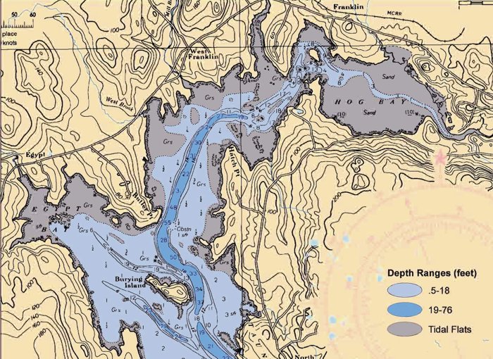
The Quebec-Labrador Foundation/Atlantic Center for the Environment led the bay management pilot project for Muscongus Bay. Friends of Taunton Bay led the project for Taunton Bay (see map detail above). The aim of both is to find ways of improving management by studying how people use the bays for such uses as fishing, research, aquaculture, education, monitoring, recreation, conservation and riparian land ownership.
CLICK ON IMAGE TO ENLARGE
The report from the Muscongus Bay project emphasizes the need for environmental and biological monitoring:
Scientific recommendations from the Muscongus Bay project included:
Taunton Bay pilot project
In an effort to put those principles into practice, FTB collected data on two dozen indicators of bay ecosystem health and integrity in six categories: species of special concern, ecosystem structure and function, toxicology, physical conditions, watershed conditions, and other indicators. Examples of FTB's findings for indicators 2005 include:
To summarize indicator findings, FTB's report uses red, yellow, and green stoplight symbols to suggest the level of concern for each indicator. Such basic information about the status of Taunton Bay had not been previously compiled, and it offers just a start toward the science needed for effective ecosystem-based management.
Peter Taylor is a consultant for the Science Translation Project of the Gulf of Maine Council on the Marine Environment.
© 2006 The Gulf of Maine Times