
April 2013 ESIP Journal
The Nova Scotia Watershed Assessment Program (NSWAP)
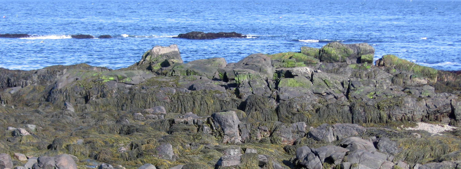
The Nova Scotia Watershed Assessment Program (NSWAP) was initiated to increase our knowledge on the current state of watersheds in Nova Scotia. In the NS Water Resource Management Strategy (2010), a knowledge gap on the pattern of watershed issues faced in the Province was formally recognized. To fill in the knowledge gap of the impacts of human activity on our watersheds, the NSWAP was launched in 2011 by the Hydrologic Systems Research Group at Dalhousie University, in collaboration with Nova Scotia Environment (NSE).
The key research questions studied are which of our province’s watersheds are most at risk; and what are the drivers of the impacts to our watersheds? The NSWAP project identifies the priority watersheds that are at the highest potential risk from activities such as land use, roads and water usage. NSWAP is a two stage study of watersheds in Nova Scotia. Part A (2011 – 2013) was developed as a rapid, desktop, GIS assessment of Nova Scotia’s watersheds with the goal of assessing potential threats to water quality and quantity to identify priority watersheds that require more resources for management. Whereas Part B (beginning in 2014) will leverage the results of Part A to study localized issues identified in priority watersheds.
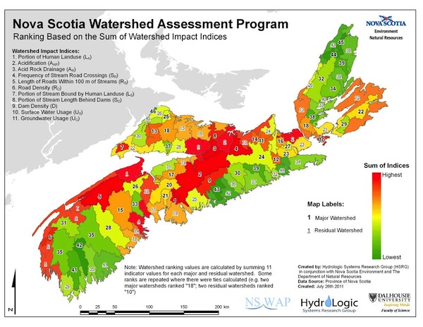
In addition to the indicator impact analysis resource management activities that are carried out by the government and various stakeholders were also included in this study. The comparison of the Watershed Values and the ongoing resource management practices identifies the priority watersheds in our regions and identifies where to focus resource management efforts in the future.
For more information please contact:
Dr. Shannon Sterling, Dalhousie University
Earth Science and
Environmental Science
Dalhousie University
1355 Oxford Street, Rm 827
8th Floor Life Sciences Centre (Biology)
PO BOX 15000, Halifax, NS, B3H 4R2
CANADA
Phone: 902.494.7741
http://myweb.dal.ca/sh732360/Sterling_Lab_Site/Welcome.html
Other News in the Gulf of Maine & Bay of Fundy
Past Journals
![]() Febuary 2015 — ESIP releases new smartphone app connecting people in the Gulf of Maine and watershed to the science happening all around them.
Febuary 2015 — ESIP releases new smartphone app connecting people in the Gulf of Maine and watershed to the science happening all around them.
![]() November 2015 — The launch of a marine debris program in the Bay of Fundy.
November 2015 — The launch of a marine debris program in the Bay of Fundy.
![]() September 2015 — Climate Change Products for Atlantic Canada.
September 2015 — Climate Change Products for Atlantic Canada.
![]() July 2015 — An update from the April 2015 State of the Bays Symposium in Massachusetts.
July 2015 — An update from the April 2015 State of the Bays Symposium in Massachusetts.
![]() June 2015 — Learn about NH Department of Environmental Services' work with 65 volunteers to improve beach grass coverage at Hampton Beach State Park.
June 2015 — Learn about NH Department of Environmental Services' work with 65 volunteers to improve beach grass coverage at Hampton Beach State Park.
![]() May 2015 — Nova Scotia recently released risk ratings for storm serge and sea level rise for all portions of the Province - this journal summarizes the findings
May 2015 — Nova Scotia recently released risk ratings for storm serge and sea level rise for all portions of the Province - this journal summarizes the findings
![]() April 2015 — Learn about an exciting project between ESIP and EPA that seeks to unravel upstream pressures on downstream estuaries
April 2015 — Learn about an exciting project between ESIP and EPA that seeks to unravel upstream pressures on downstream estuaries
![]() February 2015 — Meet the new Project Leader for the Gulf of Maine Coastal Program in Falmouth, Maine - Jed Wright.
February 2015 — Meet the new Project Leader for the Gulf of Maine Coastal Program in Falmouth, Maine - Jed Wright.
![]() January 2015 — New Smart Tour of Great Marsh - largest continuous stretch of salt marsh in New England, extending from Cape Ann in Massachusetts to New Hampshire
January 2015 — New Smart Tour of Great Marsh - largest continuous stretch of salt marsh in New England, extending from Cape Ann in Massachusetts to New Hampshire
![]() December 2014 — The American Lobster Settlement Index is an important project that assesses current lobster fishery condition in both Canada and the US. The dataset is current and available through the ESIP Indicator Reporting Tool
December 2014 — The American Lobster Settlement Index is an important project that assesses current lobster fishery condition in both Canada and the US. The dataset is current and available through the ESIP Indicator Reporting Tool
Click here for all past ESIP journals