

April 2015 ESIP Journal
ESIP and EPA team up to develop watershed-estuary connections in the Northeast
James S. Latimer (EPA) and Christine Tilburg (ESIP)
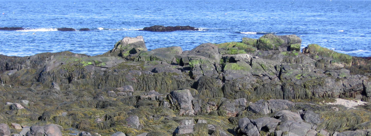
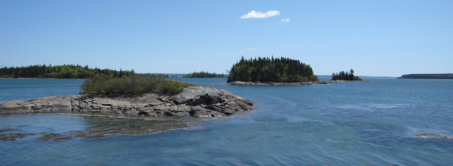
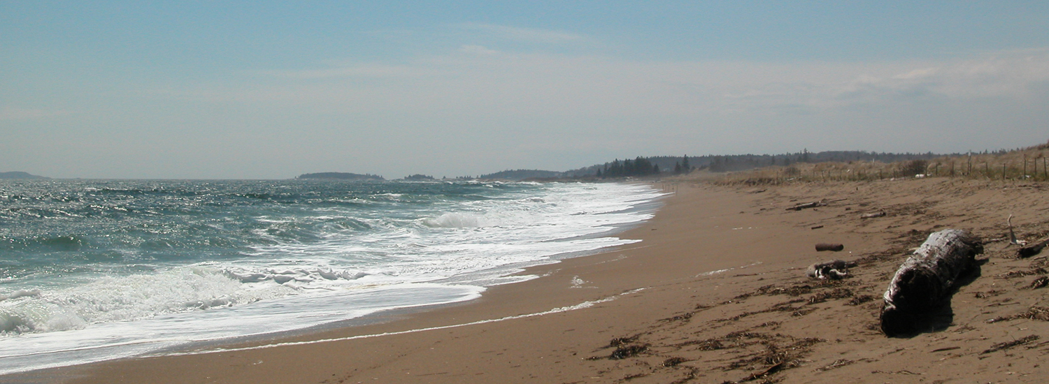
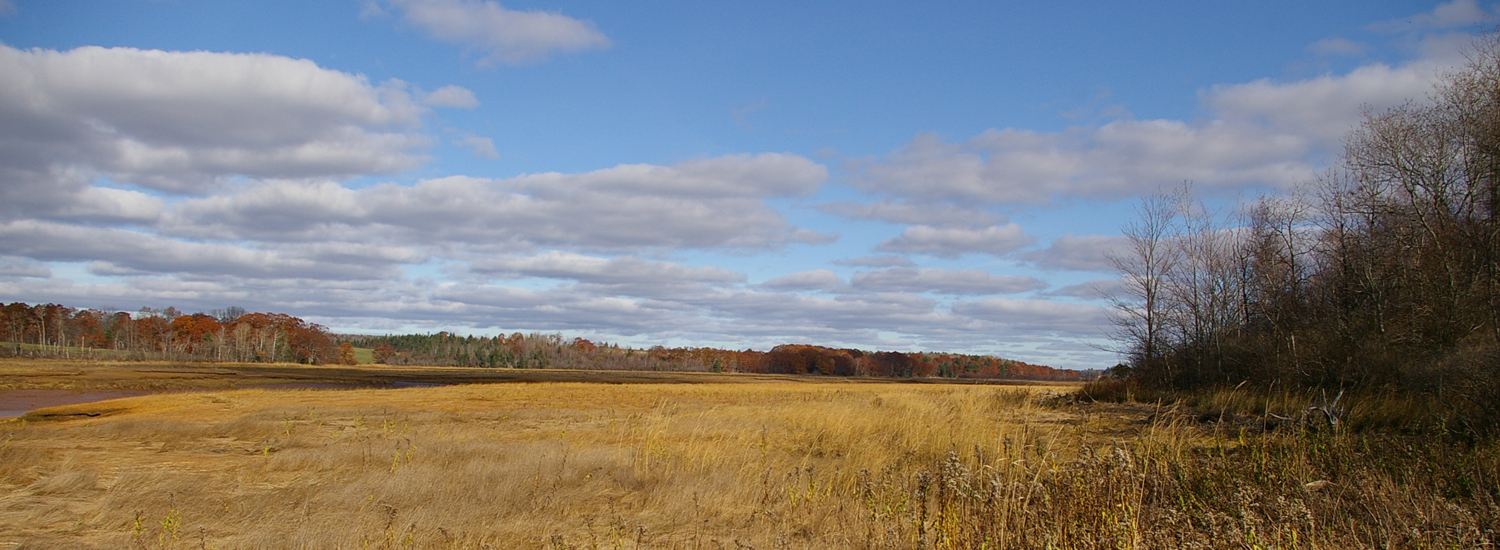
Estuarine condition is a function of the geophysical nature of the estuary, the larger ocean and atmosphere, and the upstream watershed. To fully understand and predict how an estuary will respond to drivers and pressures, each compartment must be characterized. For example, eutrophication and associated habitat effects are generally well known; what is less understood is how the particular attributes of estuarine watersheds and their spatial distributions relate to downstream estuarine conditions.
In 2014 ESIP began working with EPA’s Office of Research & Development on a project to describe the relationship between watershed characteristics and downstream estuary conditions in the northeast. Geographically the project stretches from Greenwich Cove, Connecticut to Annapolis River, Nova Scotia. The project aims to evaluate relationships between ecosystem state and impact variables (e.g., water clarity, chlorophyll-a) and watershed driver and pressure variables (e.g., land use magnitude and spatial distribution, nutrient loading). An extensive effort was put into identifying sources of explanatory variable data (including American Indian and First Nations efforts). The expectation is that this research will help with connecting watershed drivers to estuarine condition and ultimately to important ecosystem services.
This research utilizes a design based on a gradient of watershed drivers and pressures that will affect the estuaries being studied; therefore, a subset of estuaries will be in the category of least impacted and perhaps reference or normative condition (i.e., healthy characterized by the essential ecological attributes described by EPA’s Healthy Watershed Initiative). Thus, it will be possible to evaluate the degree to which estuary conditions change in relation to human affected watershed characteristics.
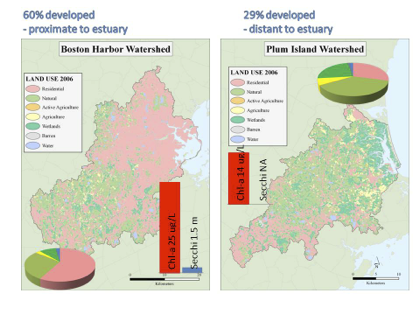
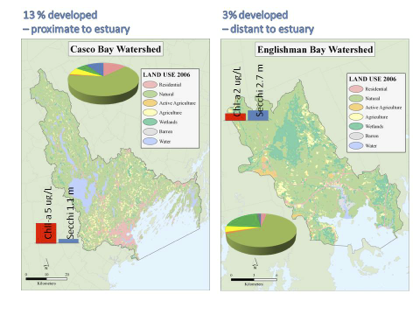
Figures above illustrate examples of land use magnitude, downstream estuary proximity, and estuary condition (using mean chl-a and secchi depth from 2000-2011)
Other News in the Gulf of Maine & Bay of Fundy
Past Journals
![]() Febuary 2015 — ESIP releases new smartphone app connecting people in the Gulf of Maine and watershed to the science happening all around them.
Febuary 2015 — ESIP releases new smartphone app connecting people in the Gulf of Maine and watershed to the science happening all around them.
![]() November 2015 — The launch of a marine debris program in the Bay of Fundy.
November 2015 — The launch of a marine debris program in the Bay of Fundy.
![]() September 2015 — Climate Change Products for Atlantic Canada.
September 2015 — Climate Change Products for Atlantic Canada.
![]() July 2015 — An update from the April 2015 State of the Bays Symposium in Massachusetts.
July 2015 — An update from the April 2015 State of the Bays Symposium in Massachusetts.
![]() June 2015 — Learn about NH Department of Environmental Services' work with 65 volunteers to improve beach grass coverage at Hampton Beach State Park.
June 2015 — Learn about NH Department of Environmental Services' work with 65 volunteers to improve beach grass coverage at Hampton Beach State Park.
![]() May 2015 — Nova Scotia recently released risk ratings for storm serge and sea level rise for all portions of the Province - this journal summarizes the findings
May 2015 — Nova Scotia recently released risk ratings for storm serge and sea level rise for all portions of the Province - this journal summarizes the findings
![]() April 2015 — Learn about an exciting project between ESIP and EPA that seeks to unravel upstream pressures on downstream estuaries
April 2015 — Learn about an exciting project between ESIP and EPA that seeks to unravel upstream pressures on downstream estuaries
![]() February 2015 — Meet the new Project Leader for the Gulf of Maine Coastal Program in Falmouth, Maine - Jed Wright.
February 2015 — Meet the new Project Leader for the Gulf of Maine Coastal Program in Falmouth, Maine - Jed Wright.
![]() January 2015 — New Smart Tour of Great Marsh - largest continuous stretch of salt marsh in New England, extending from Cape Ann in Massachusetts to New Hampshire
January 2015 — New Smart Tour of Great Marsh - largest continuous stretch of salt marsh in New England, extending from Cape Ann in Massachusetts to New Hampshire
![]() December 2014 — The American Lobster Settlement Index is an important project that assesses current lobster fishery condition in both Canada and the US. The dataset is current and available through the ESIP Indicator Reporting Tool
December 2014 — The American Lobster Settlement Index is an important project that assesses current lobster fishery condition in both Canada and the US. The dataset is current and available through the ESIP Indicator Reporting Tool
Click here for all past ESIP journals