
December 2013 ESIP Journal
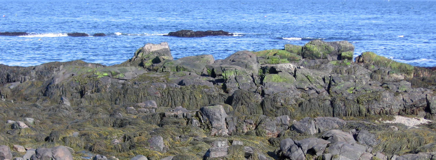
U.S. Department of the Interior supplemental funds following the devastating regional impacts of Hurricane Sandy will be used in New England to update coastal elevation data. From New Hampshire to Rhode Island, LiDAR flights will collect high-resolution 3D Elevation Program (3DEP) data that builds on regional collection in 2012 and fills in gaps remaining subsequent to the 2012 flights. The USGS 3DEP data produces 1 foot contours and has a goal to update topography and hydrography data on an eight- year cycle.
The primary goal of 3DEP is to systematically collect enhanced elevation data in the form of high-quality light detection and ranging (lidar) data over the conterminous United States, Hawaii, and the territories on an 8-year schedule. Interferometric synthetic aperture radar (ifsar) data will be collected over Alaska, where cloud cover, the large area, and the remote location preclude the use of lidar over much of the State. The enhanced elevation data support flood-risk management, natural resources conservation, infrastructure management, agriculture and precision farming, aviation safety, renewable energy development, and many other identified business applications.
For the Gulf of Maine, the availability of high resolution topographic data will improve models that forecast impacts of future storms and projected sea level rise on vulnerable communities, ecosystems, and infrastructure. Tools like the recently released Northeast section of NOAA’s Sea Level Rise and Coastal Flooding Impacts Viewer http://www.csc.noaa.gov/slr/viewer/# will incorporate the revised elevation data to refine and better portray potential impacts.
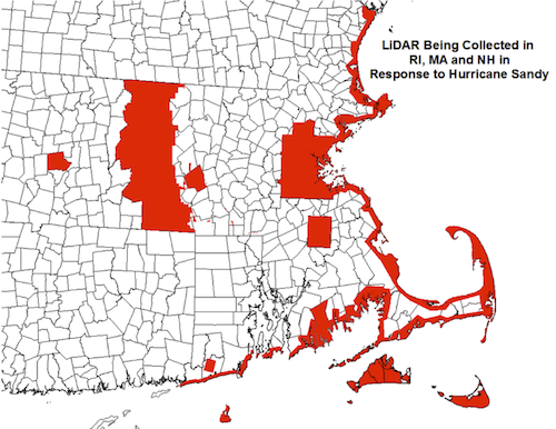
Areas in red will be collected in 2014. A seamless coastal data set from New Hampshire through Rhode Island will be included in the USGS Coastal National Elevation dataset (CoNED) as well as in 3DEP. Large interior blocks include individual municipalities and counties that provided matching funds.
Other News in the Gulf of Maine & Bay of Fundy
Past Journals
![]() Febuary 2015 — ESIP releases new smartphone app connecting people in the Gulf of Maine and watershed to the science happening all around them.
Febuary 2015 — ESIP releases new smartphone app connecting people in the Gulf of Maine and watershed to the science happening all around them.
![]() November 2015 — The launch of a marine debris program in the Bay of Fundy.
November 2015 — The launch of a marine debris program in the Bay of Fundy.
![]() September 2015 — Climate Change Products for Atlantic Canada.
September 2015 — Climate Change Products for Atlantic Canada.
![]() July 2015 — An update from the April 2015 State of the Bays Symposium in Massachusetts.
July 2015 — An update from the April 2015 State of the Bays Symposium in Massachusetts.
![]() June 2015 — Learn about NH Department of Environmental Services' work with 65 volunteers to improve beach grass coverage at Hampton Beach State Park.
June 2015 — Learn about NH Department of Environmental Services' work with 65 volunteers to improve beach grass coverage at Hampton Beach State Park.
![]() May 2015 — Nova Scotia recently released risk ratings for storm serge and sea level rise for all portions of the Province - this journal summarizes the findings
May 2015 — Nova Scotia recently released risk ratings for storm serge and sea level rise for all portions of the Province - this journal summarizes the findings
![]() April 2015 — Learn about an exciting project between ESIP and EPA that seeks to unravel upstream pressures on downstream estuaries
April 2015 — Learn about an exciting project between ESIP and EPA that seeks to unravel upstream pressures on downstream estuaries
![]() February 2015 — Meet the new Project Leader for the Gulf of Maine Coastal Program in Falmouth, Maine - Jed Wright.
February 2015 — Meet the new Project Leader for the Gulf of Maine Coastal Program in Falmouth, Maine - Jed Wright.
![]() January 2015 — New Smart Tour of Great Marsh - largest continuous stretch of salt marsh in New England, extending from Cape Ann in Massachusetts to New Hampshire
January 2015 — New Smart Tour of Great Marsh - largest continuous stretch of salt marsh in New England, extending from Cape Ann in Massachusetts to New Hampshire
![]() December 2014 — The American Lobster Settlement Index is an important project that assesses current lobster fishery condition in both Canada and the US. The dataset is current and available through the ESIP Indicator Reporting Tool
December 2014 — The American Lobster Settlement Index is an important project that assesses current lobster fishery condition in both Canada and the US. The dataset is current and available through the ESIP Indicator Reporting Tool
Click here for all past ESIP journals