


Febuary 2016 Monthly Journal
“Introducing the new ESIP smartphone app” ICUC
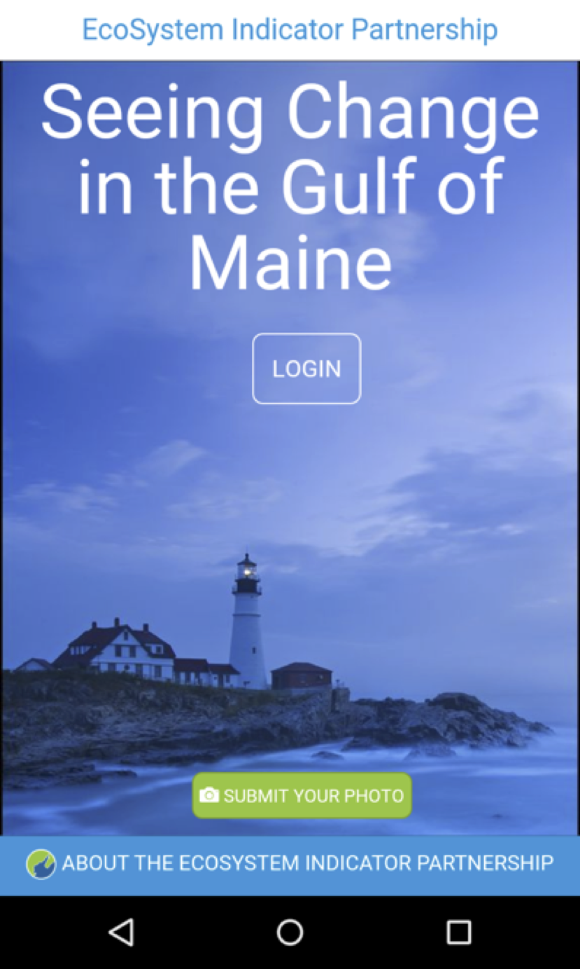
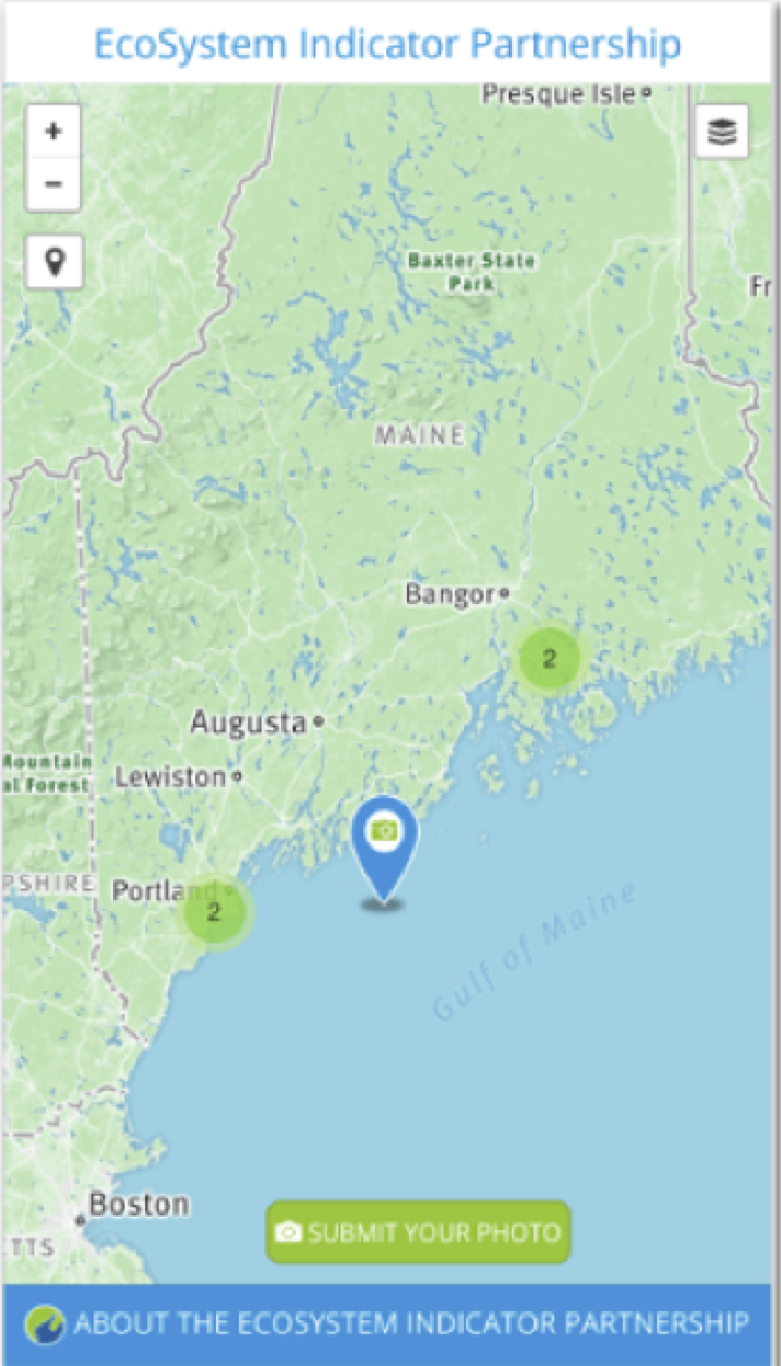
Have you ever been out and about in a new location and wondered what groups might be monitoring the environment near you? ESIP’s new smartphone app – the ICUC app (“I See You See”) helps you find the answer to that question while also using your mobile device to collect information of use to the environmental scientists in charge of managing the Gulf of Maine and watershed. The app (available from the Google Play and iTunes stores) uses your location to inform you about monitoring programs in your vicinity. In addition, you can use your phone to upload images into photo libraries or to introduce others to locations you feel are important. Once you have logged in the app (Figure 1) will pull up a map of your location with layers available to look at monitoring sites or interact with photo collection sites (Figure 2).
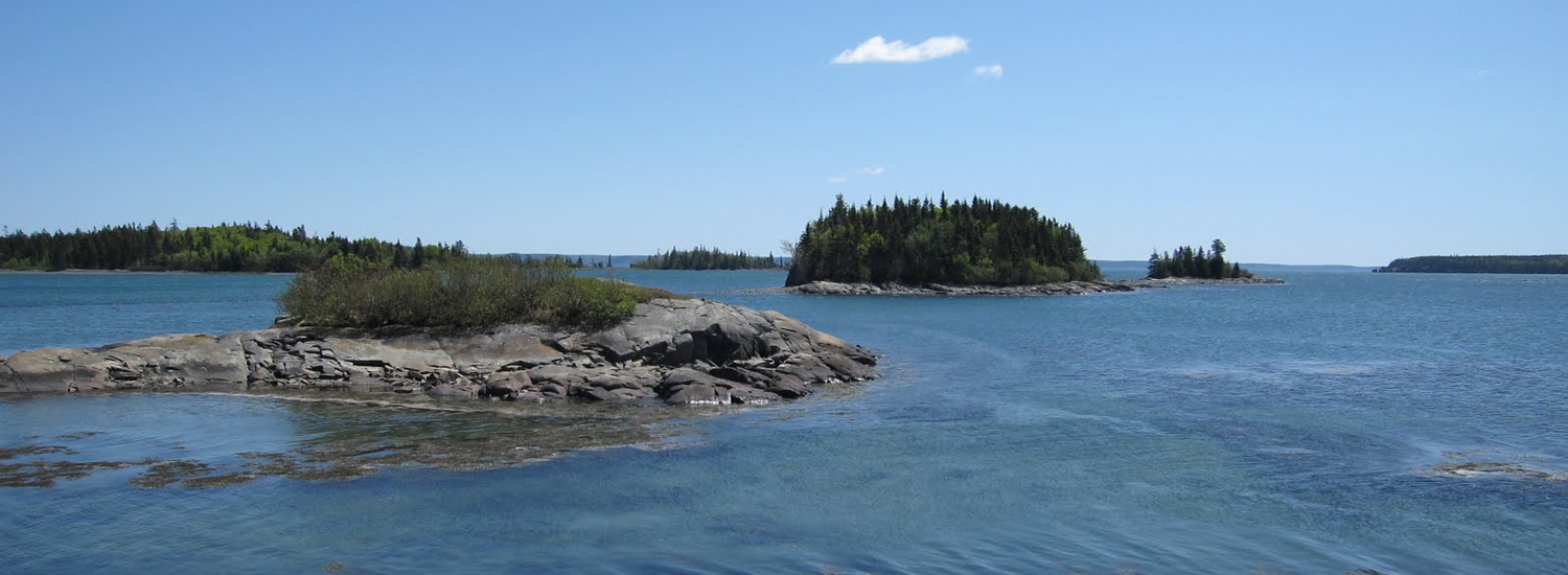
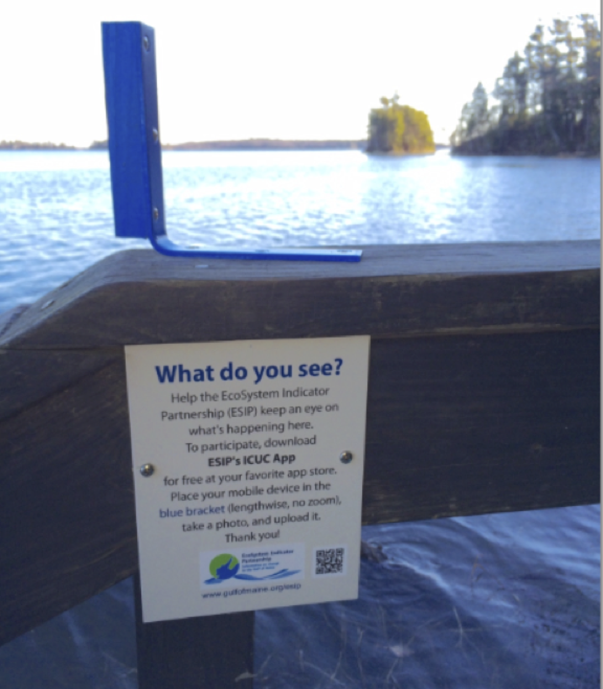
You can also use your phone to collect an image using the blue brackets at select sites (2 in Massachusetts, 2 in New Hampshire, 4 in Maine, 2 in New Brunswick, and 2 in Nova Scotia) to help build a photo library (Figure 3 shows a site in Maine). Each time you revisit the site and snap a picture the photo library grows! If you have another site you want others to discover you can take a picture there and share what is important about the site to you.
So download the app and get out there!
Other News in the Gulf of Maine & Bay of Fundy
Past Journals
![]() Febuary 2015 — ESIP releases new smartphone app connecting people in the Gulf of Maine and watershed to the science happening all around them.
Febuary 2015 — ESIP releases new smartphone app connecting people in the Gulf of Maine and watershed to the science happening all around them.
![]() November 2015 — The launch of a marine debris program in the Bay of Fundy.
November 2015 — The launch of a marine debris program in the Bay of Fundy.
![]() September 2015 — Climate Change Products for Atlantic Canada.
September 2015 — Climate Change Products for Atlantic Canada.
![]() July 2015 — An update from the April 2015 State of the Bays Symposium in Massachusetts.
July 2015 — An update from the April 2015 State of the Bays Symposium in Massachusetts.
![]() June 2015 — Learn about NH Department of Environmental Services' work with 65 volunteers to improve beach grass coverage at Hampton Beach State Park.
June 2015 — Learn about NH Department of Environmental Services' work with 65 volunteers to improve beach grass coverage at Hampton Beach State Park.
![]() May 2015 — Nova Scotia recently released risk ratings for storm serge and sea level rise for all portions of the Province - this journal summarizes the findings
May 2015 — Nova Scotia recently released risk ratings for storm serge and sea level rise for all portions of the Province - this journal summarizes the findings
![]() April 2015 — Learn about an exciting project between ESIP and EPA that seeks to unravel upstream pressures on downstream estuaries
April 2015 — Learn about an exciting project between ESIP and EPA that seeks to unravel upstream pressures on downstream estuaries
![]() February 2015 — Meet the new Project Leader for the Gulf of Maine Coastal Program in Falmouth, Maine - Jed Wright.
February 2015 — Meet the new Project Leader for the Gulf of Maine Coastal Program in Falmouth, Maine - Jed Wright.
![]() January 2015 — New Smart Tour of Great Marsh - largest continuous stretch of salt marsh in New England, extending from Cape Ann in Massachusetts to New Hampshire
January 2015 — New Smart Tour of Great Marsh - largest continuous stretch of salt marsh in New England, extending from Cape Ann in Massachusetts to New Hampshire
![]() December 2014 — The American Lobster Settlement Index is an important project that assesses current lobster fishery condition in both Canada and the US. The dataset is current and available through the ESIP Indicator Reporting Tool
December 2014 — The American Lobster Settlement Index is an important project that assesses current lobster fishery condition in both Canada and the US. The dataset is current and available through the ESIP Indicator Reporting Tool
Click here for all past ESIP journals