
![]()
Volume 7, No. 3
Promoting Cooperation to Maintain and Enhance
Environmental Quality in the Gulf of Maine
|
||||||||||
|
|
|
|
|
|
|||||||
|
|
|
|
Browse the archive |
|
|
|
|
Science Insights
Salt marsh restoration: What ecologists are discovering
By Peter H. Taylor
Some 160 square kilometers of salt marshes [62 square miles] lie along the Gulf of Maine’s coastline. These exceedingly rich habitats help sustain the health of the Gulf by filtering contaminants, providing food for crabs to blue herons and acting as fish nurseries.
Over the past four centuries, salt marshes have faced relentless pressure from development, agriculture and pollution. According to one estimate, 25 to 50 percent of coastal wetlands in Massachusetts, New Hampshire and Maine have disappeared since the colonial era. In the Bay of Fundy, 75 to 85 percent of salt marshes have been lost, due primarily to the diking of farmland. Despite heightened legal protection and public awareness, salt marshes are still in jeopardy, stressed by the ever-growing human population.
Part of the remedy, according to some scientists and resource managers, is to restore damaged salt marshes and even construct new marshes to mitigate losses. Of particular concern are roadways and dikes that cut off marshes from natural tidal rhythms, altering their ecology and increasing their vulnerability to invasive plants. Restoration projects can reconnect these strangled marshes with the sea.
Local, state, provincial and federal agencies and citizens’ groups around the Gulf of Maine are working to understand the best ways to help coastal wetlands recover and to put these techniques into practice. Some of these efforts are reflected in the September 2002 issue of the journal Restoration Ecology, which focused on marsh restoration. Scientists from this region, including members of the Gulf of Maine Council’s Habitat Subcommittees, contributed articles. The studies offer valuable information and tools for resource managers and marsh restoration practitioners.
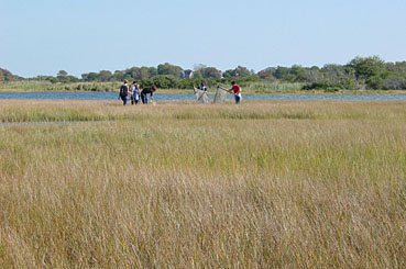 |
| Restoration team at Drakes Island, Maine Photo: Michele Dionne |
Measuring success
One approach that is sometimes used to offset the loss of marshes is to create man-made marshes. Substituting human ingenuity and sweat for the ecological and geological processes that normally shape natural marshes over centuries, scientists and engineers bulldoze imported soil into a marshlike configuration and plant marsh vegetation.
The bold assumption is that the constructed habitat will eventually perform the same functions and have a similar ecological value as a natural marsh. The new marsh is thought to follow a trajectory toward the characteristics of a marsh created by nature. Little is known, however, about the validity of that assumption. Do man-made marshes actually perform as well as natural marshes? How long does it take?
A study in the special issue of Restoration Ecology examines these questions by looking at salt marshes—11 natural, six constructed—in New Hampshire’s Great Bay. The researchers, Pamela Morgan of the University of New England and Frederick Short of the University of New Hampshire, selected marshes constructed one to 14 years ago and compared them to similar natural, or reference, marshes nearby. Other studies have tracked the performance of individual man-made marshes over many years, but the approach taken by Morgan and Short, using several marshes of varying ages, enabled them to get answers about trajectories more quickly.
The findings are encouraging. As one would expect, the natural and man-made marshes did show differences, but most of the discrepancies occurred in recently constructed marshes. The natural marshes tended to have more production of plant biomass, soil richer in organic matter, and a greater variety of plant species. By plotting these variables versus age of the constructed marshes, Morgan and Short created graphs that show how man-made marshes change over time. These trajectories indicate that the constructed marshes do become increasingly similar to natural marshes. Some characteristics, including plant production, sediment deposition and plant species richness, approach natural levels within a decade, but others like soil organic content may take longer. The study makes several important points:
By monitoring key variables in constructed marshes and comparing the data to known trajectories, managers could determine whether, and when, a constructed marsh is likely to attain the functional characteristics of a natural marsh.
Monitoring protocols can be improved if trajectories are known for constructed marshes in a region.
Natural marshes show tremendous variability, so reference marshes must be chosen carefully for comparison to manmade marshes.
Predicting effects
Culverts installed under roads to allow the passage of seawater into coastal wetlands are often undersized and improperly located, strangling the marsh. Because such culverts are commonplace, tidal restrictions remain one of the biggest problems for the region’s salt marshes.
Sometimes the solution might seem obvious: Install larger culverts. Yet hydrology and ecology are complex. If a marsh has subsided or not kept pace with sea-level rise, for example, suddenly restoring full tidal flow can result in excessive flooding, killing plants.
To help managers test possible appropriate restoration actions, Roelof Boumans, David Burdick and Michele Dionne present in the September 2002 issue of Restoration Ecology a computer model that predicts how a marsh will change after modification of culverts or other tidal restrictions. It can be used to test possible solutions.
The researchers developed and applied the tool using field data from three marshes in Maine, New Hampshire and Massachusetts. It takes into account the dimensions of the existing culvert, hydrology of the marsh, distribution of plant species in relation to elevation and other factors.
Each of the marshes had a different history of impoundment and restoration, and the model enabled the scientists to explore the short- and long-term outcomes of various alternatives for restoring tidal flow. Some of the outcomes would not necessarily be obvious. For example, the Drakes Island marsh in Wells, Maine, had a 0.9-meter [2.9 foot] culvert that constrained tidal range and prevented the marsh from fully draining, disrupting the rhythm of high and low tides. Using the model, the scientists tested four possible scenarios to change the hydrology, developed in collaboration with neighboring landowners and other stakeholders. They found the following results:
Putting a flap gate on the existing culvert would cause the marsh to transform into a freshwater meadow.
Doubling the culvert diameter would restore tidal range and double the flooded area, but low-elevation vegetation would be lost, short-circuiting the desired development of high marsh habitat.
Installing a second culvert with the same diameter as the existing culvert would produce a less dramatic increase in tidal flooding. Sediments and vegetation would accumulate to create high marsh.
Finally, installing a second identical culvert and installing a flap gate on the existing culvert would increase drainage relative to flooding, promoting the spread of Spartina alterniflora at low elevations but enabling freshwater plants to expand into the edges of the marsh.
The decision regarding which option to choose would depend on the management goals. This case study and two others in the Restoration Ecology paper illustrate the complex and sometimes unexpected changes that can occur. The model offers managers and other practitioners of salt marsh restoration a tool for making informed decisions based on predicted results of management alternatives.
A protocol for regional marsh assessment
An important but often overlooked component of any salt marsh restoration project is monitoring. Effective monitoring is necessary to determine if projects are fulfilling their objectives and which restoration techniques are most effective. Ideally, these assessments would compare restored marshes to reference marshes over many years. However, funding has typically precluded comprehensive, long -term monitoring. Moreover, differences in protocols between projects hobble regional assessments of marsh restoration.
To address these issues, scientists from the Gulf of Maine published in the September 2002 issue of Restoration Ecology a monitoring protocol to assess tidal restoration of salt marshes on local and regional scales. The protocol was created through consensus among some 50 restoration experts. Intended to be cost effective and practical, it calls for creation of a baseline habitat map and monitoring a core set of variables for hydrology, soils and sediments, vegetation, fish, invertebrates and birds. Widespread adoption of the protocol by local projects could enable regional performance assessments of marsh restoration throughout the Gulf of Maine.
With the collective effort illustrated in the Restoration Ecology papers, the ebbing health of salt marshes in the Gulf of Maine may gradually recover.
Peter H. Taylor (ptgomc@suscom-maine.net) is a science translator and Web producer for the Gulf of Maine Council.