Fish tagging technologies help solve a mystery
Where do the fish go? Some go down the ‘haddock highway’
By Rebecca Zeiber
The movements of fish can be extremely difficult to track in the vast ocean waters, but years of collaboration between fishermen and scientists have helped to improve fisheries stock assessment models and tracking technologies.
Various fish tagging initiatives have led to much-needed improvements in fisheries stock assessment models and tagging technologies, experts say.
The 2008 Northeast Regional Tagging Symposium, held last fall at the University of New Hampshire (UNH) in Durham, attracted approximately 140 people. Attendees, including commercial and recreational fishermen, fishery biologists and managers, and university faculty and students, learned about how fish tagging data is used for stock assessments and for evaluating closed areas for commercial fishing.
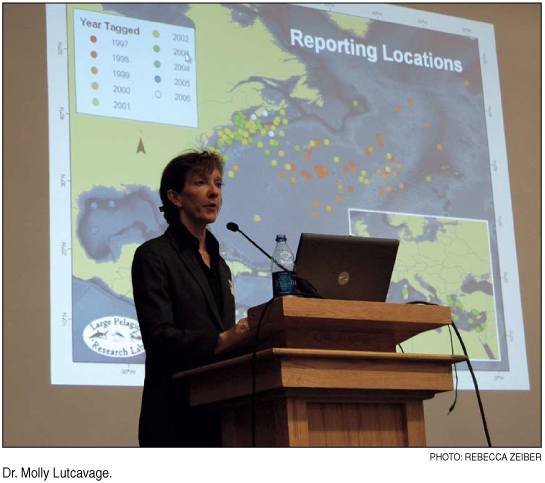
Molly Lutcavage, director of the Large Pelagics Research Center (LPRC) at UNH, one of the symposium’s two keynote speakers, offered a presentation on bluefin tuna movements in the Atlantic.
Electronic tags, particularly pop-up satellite tags, have been essential in determining the movements of bluefin tuna, she said. The tags estimate geolocations of the fish based on the angle of the sunlight. Overall, these tags have provided a wealth of information regarding the migration patterns of this species.
Some of the more recent findings from the electronic tags show that bluefin seem to be homing to a forage ground near Nova Scotia, Lutcavage pointed out. In addition, the LPRC recently began a program called “Tag a Tiny” to learn about the movements and associated thermal gradients of juvenile bluefin tunas.
Fish as young as three to five years old have been found crossing the Atlantic, something that had previously thought to be associated only with the adults.
“Without electronic tags, there would be no way we’d figure out bluefin tunas have such diverse dispersal patterns,” Lutcavage said.
Others speakers told of the use of tagging studies in locations closed to commercial fishing. In particular, researchers wanted to learn if fish used these closed areas as a “safe zone” by staying inside the boundaries.
While some closed areas seemed to lack an obvious pattern of fish movement, areas such as the Western Gulf of Maine closure area seemed to have areas where fish stayed inside the closed areas.
In particular, one researcher described a “haddock highway” where this species would travel along a route in the closed area and would turn around once it reached the boundary, only to travel the same route back.
Tom Nies from the New England Fishery Management Council weighed in with his perspective on why data from tagging studies are important in determining fishery management plans.
“Tagging studies are helping to get at the root of the situation, and the answers they provide will only help improve our understanding of the fish populations,” Nies said.
Other speakers discussed how fish species are being tracked to improve their stock assessments. Using mark-recapture studies with simple tags, researchers have learned about the mortality rates and movements of striped bass, yellowfin tuna and Atlantic cod in the western Atlantic Ocean. Thanks to years of tagging efforts by fishermen and researchers, fishery managers will be able to develop more accurate population estimates to protect and enhance stocks of various species.
Keynote speaker David Welch from the Kintama Research Corporation in British Colombia, Canada, spoke about the Pacific Ocean Shelf Tracking (POST) array, a highly advanced fish tracking system. POST relies on a number of wireless platforms deployed in the waters near Vancouver Island, along the coast of Alaska and into some rivers of the western United States. The platforms are receivers for the tag signals inserted in fish such as salmon and dogfish. As fish with tags swim near the receivers, the date, time and tag number are recorded.
“It’s like a fish EZ Pass,” Welch said. “This is a tracking system that’s so good, we can learn exactly how many fish from a certain release are moving through a particular area.”
The Pacific populations of economically valuable fish including black cod and salmon are expected to benefit from these technologies. The POST array data have already had huge impacts on improved population models thanks to detailed information on the fish movements.
“When you can do experiments like this directly in the ocean, it helps to move science forward much faster than more traditional studies,” Welch added.
The symposium was funded by the National Oceanic and Atomospheric Administration’s NOAA Fisheries, NH Sea Grant, the Northeast Consortium and several fish tag manufacturers. A publication based on the symposium will be available early next year. For more information on its availability, keep an eye on www.seagrant.unh.edu.
[ back to top ]
|