
![]()
Volume 6, No. 4
Promoting Cooperation to Maintain and Enhance
Environmental Quality in the Gulf of Maine
|
|
|
|
|
|
|
|
|||||||
|
|
|
|
Browse the archive |
|
|
|
|
Wind, rain and tides aside, kayakers’ journey
eased by apple pies and common concerns
By Andi Rierden, Editor
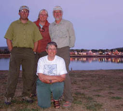 |
| In Annapolis Royal, NS: Rich MacDonald, Natalie Springuel, Dan Earle and Sue Hutchins (kneeling) Photo: (c) 2002 The Spectator, reprinted with permission |
The early part of the trip was plagued with weather woes, including two nor’easters. In New Hampshire, the team had to cancel a much-anticipated kayaking trip to the Isles of Shoals six miles out to sea because of high winds. Heavy fog, winds and tides forced them to hire a lobster boat to ferry them half way across the Bay of Fundy from Alma, New Brunswick to Cape Chignecto. They then kayaked through fog for ten miles to mainland Nova Scotia in an area frequented by fishing boat and barge traffic. Perhaps the biggest disappointment came when Hurricane Isidor forced the team to end its journey four nautical miles from its final destination.
But once ashore the team encountered endless and often unexpected generosities, from home made pies and Internet access to a short course in weir operations. In case you missed the team when they visited your area, the following excerpts and images will give you a glimpse of their historic journey.
If it keeps up like this...I quit! I’m grouchy, my muscles ache and the blasted wind just won’t quit… We keep grounding out in our attempt to find the deep-water channel into Barnstable Harbor…I replay in my mind the weeks of hectic preparation for leaving Yarmouth, Nova Scotia: the week in Bar Harbor with Nat and Rich trying to amalgamate two couples’ gear, food and efforts into a smoothly operating team; the pre-launch day on the Cape dealing with all the last minute issues; the stress of getting ready to launch, under the gaze of the public eye, not really knowing for sure that everything would fit into these small boats. At any moment, I expected to hear, “You are the weakest link...goodbye.” What can I add to a group that contains two biologists, a landscape architect and two registered kayak guides?…On top of this, no one else is talking. About gear, yes, about technology, yes, about the route, yes. But about aches and pains? No. About fears or irritations? No. Am I the only one struggling here?
The next day…
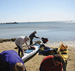
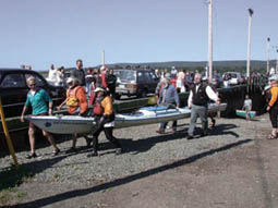
The Provincetown, MA launch |
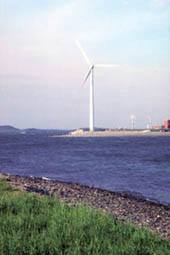
Cape Cod wind farm |
Finally, the wind is at our backs…As we raft up for a gorp break we finally get around to my kind of topic. “How are we all doing?” Natalie asks. I take a deep breath and let it all out. My insecurities, my aches and pains, and my irritations. In return I get to know what they are feeling: the pressures they, too, have been dealing with...And I may have just found my niche. Let Rich do the birds, Dan the landscape and Nat the intertidal zone. The fascinating part of this journey, for me, will be the people.
–Sue Hutchins
At the 1,000-acre Wellfleet Bay Wildlife Sanctuary–one of the most well-managed preserves I have seen–I saw a northern bobwhite (Colinus virginianus), while a great crested flycatcher (Myiarchus crinitus) called in the pines above. Everywhere there is a sandy beach, “peeps” and other shorebirds are usually countable in single integers, but occasionally I have seen groups of several hundred...
–Rich MacDonald
Right here, in the heart of a large urban area, we find open space… having paddled the coastline from Provincetown to Boston, the only reliable and freely accessible land areas for a water-based recreationist to camp are in the heart of Boston Harbor. Elsewhere along the coast you need special permission or arrangements with owners, such as we have had, to camp legally.
–Dan Earle
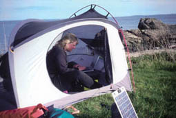
Natalie on laptop updating the team's Web site. |
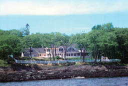
A snapshot of Maine's increasing development |
Rye, New Hampshire…
“Did you really come all the way from Maine in those little things?” asked the beach-combers at Crane Beach Wildlife Refuge near Essex Bay, Massachusetts. The same question came from the campers at Salisbury Beach State Reservation in Massachusetts, and again from visitors at the Seacoast Science Center in Rye, New Hampshire. It has become a regular inquiry. “Gulf of Maine Expedition.” The word “Maine” is the only clue; we must have kayaked from Maine. In three weeks of paddling, we’ve confirmed one thing: the concept of the Gulf of Maine has not yet reached the general public. Sometimes it makes me want to advocate going back to the Gulf’s old historic name, Bay of Norumbega, just to make it clear that the Gulf of Maine spans far beyond coastal Maine’s borders.
–Natalie Springuel
Southern Maine…
In the southern third of the Gulf of Maine, the vast majority of the shore is accessible only to the wealthy, and they maintain rights to the low-tide line. From our very subjective assessment, the percentage of shorefront property that is privately owned (excluding protected lands and urban areas) must fall between 60 and 80 percent depending on the location.
Community organizers involved in watershed protection in the Cape Neddick region of southern Maine typify what seems to be happening all over the southern Gulf…The all-volunteer Cape Neddick River Association is concerned that high levels of fecal coliform may be polluting the estuary, not only making it dangerous to eat shellfish but also making it unsafe to swim. Linda Scotland, and 20 or so neighbors, have come together to create the association to address issues of water quality in their small watershed. The issue is complicated by an outfall pipe that drains all the sewage from the Town of York into the Cape Neddick River mouth, while the residents along the river all have septic systems. Development in the region continues to grow rapidly.
–Natalie Springuel
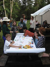
Gulf of Maine Mural Project,
Warren Island, ME
Down East, Maine…
While camped close to Jonesport, we chatted with the campground manager who expressed his concerns about the new summer folk who are moving in. They buy shorefront property and build large summer homes. This raises taxes and local folk can no longer afford to live on the water. Young local couples have to go inland to afford a home. My assumption was that this phenomenon had not yet reached Jonesport. I was wrong.
–Sue Hutchins
As we get ready to cross into Canada in two days, I look back over the U.S. portion of this journey. If there is one thing I have learned so far, it is that coastal development is a very real issue that could change the character of the Gulf of Maine. And this trend is moving east.
–Natalie Springuel
New Brunswick…
We paddled today from Morans Island on the eastern outskirts of Passamaquoddy Bay to Orange Cove, about ten nautical miles east. We left at low tide expecting to ride the flood current all day. Instead, we found it flowing against us. Surprised–not to mention a little more tired than expected–I spent some time this evening looking at marine charts, as well as tide and current tables, trying to figure this out…I now have a new theory. We must have underestimated the geographical edge of current from the Passamaquoddy Bay tidal flood…Islands as large as Campobello and Deer, and others no bigger than ledges and shoals, act as barriers that funnel the water in multiple directions. I cannot help but wonder how these local currents affect the greater diversity of species dispersal in the whole Gulf of Maine system.
–Natalie Springuel
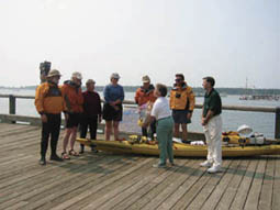
Local organizer Lee Sochasky welcomes the team to |
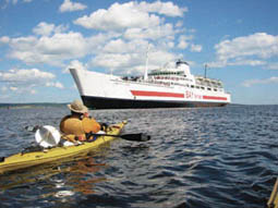
Ship ahoy! near Saint John Harbour, NB |
Fundy fog…
We pay close attention to our VHF radios. If there is other boat traffic out there, staying tuned to channel 16, the international emergency and hailing frequency, is one way we might find out. We will sign on and announce ourselves. “Securité. Securité. This is the Gulf of Maine Expedition. We are three kayaks crossing from Cape Chignecto to Hall’s Harbour on a bearing of 180 degrees. We expect the crossing to take four hours. Gulf of Maine Expedition standing by on channel 16. Clear.”
Crossing from Cape Chignecto to mainland Nova Scotia we were fog-bound the whole way. This was a “thin” fog with visibility ranging to several miles. Still, to leap forward into a ten-mile crossing, unable to see the far shore, blindly trusting to navigational technology can cause one to be a bit anxious.
–Rich MacDonald
Contrasting coastlines
New Brunswick’s coast is remembered as tall cliffs broken at intervals by big river valleys with large shingle beaches at the sea. While there were signs of human use there was little development and little contact with people. Concentrations of population were far inland. The Nova Scotia coast is punctuated by a series of small ports and towns, each with its own particular character. The list bears mention — Baxters Harbour, Halls Harbour, Huntington Point, Canada Creek, Harbourville, Morden, Margaretsville, Port George, Port Lorne, Hampton Beach, Phinneys Cove, Youngs Cove, Parkers Cove, Delaps Cove.
–Dan Earle
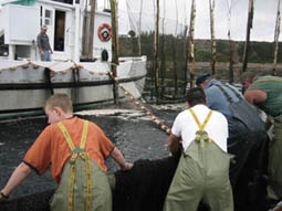
Herring weir in operation, Digby Neck, NS
As we climbed the cobble beach, the figures came into focus. The first two bodies were young seals, their eyes open, their heads covered in blood. The third body, the one I had spotted from my kayak, was much larger, much further decomposed, and still had a large rope around its torso. Darrin Kelly, a field naturalist, was with us for this leg of the trip. He picked up a piece of driftwood and poked their skulls. There was no resistance. The skulls had been crushed. We were looking at the remains of three seals that had been clubbed to death. I had not expected to see this sight in Nova Scotia. A few miles earlier we had passed an active fishing weir. Was there a connection here? Had the seals been unwelcome visitors?
Each day of our journey has two parts, the adventure of the paddle and the adventure of finding our night’s accommodation. As we move up the Bay of Fundy, this process has become easier. There is much greater public access and many beaches from which to choose than in the southern portion of the Gulf. Our latest reception, at Hall’s Harbour, Nova Scotia, consisted of cold lemonade and cookies on a red bench in front of Raymond and Clara Jefferson’s cottage. Aunt Ina, at 92 years old, was the perfect hostess.
I recently spoke with Don Rice at the Annapolis Royal farmers market. Don is an environmentalist and extraordinary potter from Bear River, Nova Scotia, whom I admire greatly. He said that our paddle is having a positive effect…Our neutral political stance makes it easier for people in different political camps to talk about us and the issues we are observing. It is rewarding to hear that our main objective, raising awareness about the Gulf (or the Greater Bay of Fundy as some Nova Scotian locals call it) is being met.
–Sue Hutchins
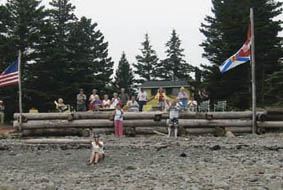
Nova Scotia welcomes the team in Halls Harbour (left) and Annapolis |
|
On August 19th, we left Huntington Point, paddling south and west in the direction of Yarmouth. As we were paddling past Canada Creek, I was closest to shore, when, perhaps 50 yards out, I saw a spout! Slowly, the long, dark back of a whale emerged, arcing through the surface of the water, curving back into the shallow depths. A North Atlantic right whale! We had just witnessed 0.3 percent of the entire North Atlantic right whale population!
–Rich MacDonald
Cape Sable, Nova Scotia
Hurricane Isidor picked up the wind. Our paddles hit the barrage head-on when we rounded the corner of mainland Nova Scotia. Barely moving at less than one nautical mile per hour, the team paddled in silence...At Prospect Point in Shag Harbor a few team-members voiced concern about continuing. One seemed particularly shook by the piercing, cold wind. Another was resolute in his statements he was done; he felt it was time to stop. A quick on-the-water conference ensued, and the Gulf of Maine Expedition came to an end, four nautical miles short of the end.
My goal-oriented gut had a hard time letting go. I wanted to push the final four miles, even if it took our team of six, five hours. I wondered aloud about splitting up the team? Fortunately, winds gusting 20 to 25 knots brought me to my senses. Better to go in as a team than split at the final hour. We had paddled 1,000-1,300 miles (the jury is still out) over the last five months. We were finally at the southwestern tip of Nova Scotia, the landward end of the Gulf of Maine.
Back home in Bar Harbor
People have asked us what the highlight of the trip was. Not a simple question. So many images come to mind it is hard to narrow down to just one: weird monkfish egg masses; migrating semi-palmated plovers and least sandpipers; cliffs and more cliffs; urban wilderness; caves and scoured rock faces; tides the size of my house; currents up to eight knots; the people.
I was struck by the smallness of the Gulf, not in mileage but in politics, history, economics, nature…In New Brunswick we found floating wood chips that had been milled in Nova Scotia. In Nova Scotia we watched as herring, destined for processing in New Brunswick, were being hauled up. In Massachusetts we found that salt-water access to the shore for hand-powered boaters was virtually non-existent. In Maine, where over-use and access becomes a complicated management problem, we ceded our campsite to a Massachusetts group seeking respite from the development back home. The region’s issues are absolutely intertwined.
–Natalie Springuel
The team’s final report is due out in early 2003. They continue to educate the public about the Gulf through slide presentations and lectures. You can find the full transcript of the team’s journals along with air and water quality data at www.gomexpedition.org.