Proceedings from the Workshop Integrating Seafloor Mapping and Benthic Ecology into Fisheries Managment in the Gulf of Maine held April 15-16, 2009 in Portland, Maine
Click here to download GOMMI documents. You will need a username and password.
Mapping the Gulf of Maine seafloor is one of the essential first steps for achieving effective management of the region’s marine environments.
The Gulf of Maine Mapping Initiative (GOMMI) is a U.S.-Canadian partnership of government and nongovernment organizations to conduct comprehensive seafloor imaging, mapping, and biologicaland geological surveys. GOMMI grew out of a mapping workshop in October 2001 that was sponsored by the Gulf of Maine Council on the Marine Environment and the National Oceanic and Atmospheric Administration. The Gulf of Maine Council endorses GOMMI, and the GOMMI Steering Committee is a subcommittee of the Council. Currently, GOMMI is working to secure funding and conduct a mapping program of areas in the Gulf of Maine not already mapped by multibeam sonar surveys.
Map of areas covered by high-resolution bathymetric surveys as of February 2009
GOMMI has released its strategic plan for review and comment. Download the
document by clicking the following links.
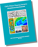 |
Gulf of Maine Mapping Initiative: A Framework for Ocean Management
|
In December 2006, Susan Snow-Cotter, a steering committee member of the Gulf of Maine Mapping Initiative (GOMMI) and director of the Massachusetts Office of Coastal Zone Management (CZM), died of inflammatory breast cancer. Susan’s vision and leadership were instrumental in establishing GOMMI and advancing seafloor mapping in the Gulf of Maine. Through GOMMI and many other programs, she was a leader in coastal and ocean management in the Gulf of Maine and beyond.
GOMMI tribute to Susan Snow-Cotter (PDF, 56 KB)
GOMMI tribute to Susan Snow-Cotter (Word, 155 KB)
- Issue 3 (November 2008): PDF version (84 KB)
- Issue 2 (July 2007): PDF version (84 KB) or Word version (89 KB)
- Issue 1 (July 2006): PDF version (88 KB)
- Map of areas covered by high-resolution bathymetric surveys as of February 2009
- Overview of mapping technologies
- General information about GOMMI and seafloor mapping (PowerPoint, 4.8 MB)
- On April 11, 2006, GOMMI presented a poster entitled Gulf of Maine Mapping Initiative: A Framework For Regional Fisheries Research And Management (PDF, 183 KB) at the conference on “Geographic Information Systems and Ocean Mapping in Support of Fisheries Research and Management.”
- Summary of 2006-2008 Planning Workshop (February 17, 2006) (PDF, 107 KB)
- User needs assessment for the Gulf of Maine Mapping Initiative (Final version) (PDF, 2.7 MB)
- Talking about a revolution: The Gulf of Maine Mapping Initiative
Cover story in NOAA’s Coastal Services magazine (March/April 2004) - Gulf of Maine Mapping Initiative (GOMMI) fact sheet (PDF, 329 KB)
- Mapping
the undersea landscape: Using seafloor maps to improve management
of the Gulf of Maine (PDF, 455 KB)
Produced by the Science Translation Project of the Gulf of Maine Council.View online version (HTML)
- Knowledgebase: Seafloor mapping
Web page with links, scientific papers, and
other information on seafloor mapping. - The Geoscience for Oceans Management Program of the Government of Canada
The Geoscience for Oceans Management Program of the federal department of
Natural Resources Canada will deliver the geoscience knowledge base for
informed decision-making in Canada’s offshore lands to ensure that
natural resource development does not harm the environment and that
appropriate land-use decisions are made balancing social, economic, and
environmental considerations. The Canada Oceans Act and the Canada
Oceans Strategy provide the legislative and strategic framework within
which integrated management of Canadian ocean territory can be extended
to the offshore. Underpinning the GOM program is a systematic approach
to seafloor mapping to deliver geoscience knowledge for integrated ocean
management. - Gulf
of Maine marine habitat characterization and mapping: A workshop
report and strategy for ocean mapping in the Gulf of Maine (PDF,
6.7 MB)
Proceedings from the October 2001 mapping workshop that was sponsored by the
Gulf of Maine Council and the National Oceanic and Atmospheric Administration.
| Chair: |
VACANT
|
| Staff: |