
Environmental Quality in the Gulf of Maine
|
|
|
|
|
|
|||||||
|
|
|
|
Browse the archive |
|
|
|
|
By Lee Bumsted
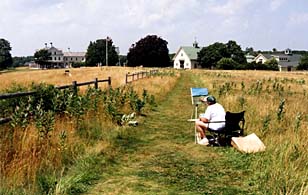 |
| Laudholm Farm courtesy of the Wells Reserve |
In the exhibit area of the Maine Coastal Ecology Center at the Wells National Estuarine Research Reserve in southern Maine, Mya, the four-foot-tall talking clam, is pretty intriguing, and the grasses in the salt marsh diorama seem to be growing. But what really catches my eye is a four’ by eight’ plate-glass window into an interior laboratory. This view of people working at lab benches is striking. It also tells me that this is a place where educational outreach and research exist side-by-side.
The occasion this autumn day is my first-ever trip to the Reserve, located a mere mile from noisy Route 1 with its antique and lighthouse souvenir shops. As I drive up, I am surprised by the sweeping views of open meadows and the scattered yellow buildings of Laudholm Farm, all part of the approximately 1,600-acre [647 hectare] Reserve.
There’s much to see at the Reserve in addition to the Maine Coastal Ecology Center. The restored farmhouse (now a visitor center), barns and farm outbuildings rate a listing on the National Register of Historic Places. But first I decide to explore some of the seven miles of trails. I opt for an easy walk that takes me through open uplands and an abandoned apple orchard down to the salt marshes of the Webhannet River estuary. I stop there to talk with a couple of regular visitors who are seated on a bench and watching for shorebirds. The sound of the surf draws me out to the ocean, where high tide makes it an even bet I’ll get my feet wet running to a spot to enjoy my picnic lunch. On my return trip I follow a boardwalk bordering a brackish marsh. Interpretive signs help me identify plants and birds along the way.
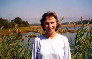 |
| Lee Bumsted at the Wells Reserve Photo courtesy of Lee Bumsted |
Approximately 40,000 people visit the Reserve each year. Some come just to enjoy the trails and view the displays. Others join interpretive walks led by Reserve staff members and volunteers. Walk topics include salt marsh ecology, coastal geology, climate change and wildflowers. Lunchtime and evening lectures, school field trips and summer day camps for children are other draws. In-depth workshops offer the latest information on the effects of development, coastal erosion and water pollution to residents and to those responsible for coastal land-use decisions.
During the winter months, there are fewer programs and visitors, but still chances to explore the property, view the educational displays, or check out books from the Coastal Resource Library. Now that I’ve discovered this tucked-away gem, I vow to come back in February with my snowshoes. All seven miles of trails are open to cross-country skiers and snowshoers.
Though the winter months are much quieter, the Reserve hosts as many as 100 visiting researchers and assistants over the course of the year, mostly in the summertime. The Reserve’s staff members remain, however, studying the samples they collected when it was warmer, then analyzing and documenting the resulting data. Their research is geared to producing information needed to maintain or improve coastal habitats and resources in the Gulf of Maine. They have a particular focus on the ecology of salt marshes.
On a second visit to the Wells Reserve, I have the opportunity to talk with Michele Dionne, the research director. She tells me that one major area of study at the Reserve this winter will be the effects of increased shoreland development—the impact of nutrients and other contaminants running off into the ocean, plus the loss of freshwater that would otherwise drain back into the aquifer. Another research topic is: Where is sewage going once it has been treated, and what effects do all the remaining nutrients have?
Dionne notes that through their research, the Reserve’s staff members hope to support a more regional approach to watershed planning. Too often, she says, local municipalities lack data and they work alone, without integrating their efforts with others sharing their watershed. “We are trying to develop regional-level budgets for water use, water use capacities, the capacity to accept waste and shoreland land use,” she says. A project in the works is the development of Web-based information tools to help with regional planning of coastal watershed resources.
Having educational outreach staff working under the same roof with scientists at the Wells Reserve will help ensure that the results of these latest research projects will be shared with the general public and those making decisions about coastal resource management.
The trails at the Wells National Estuarine Research Reserve are available every day. The visitor center and Maine Coastal Ecology Center are open January 16 through December 15. Visit www.wellsReserve.org or call (207)646-1555 for more information.
Lee Bumsted is a certified kayaking instructor who writes about outdoor issues in Maine. She lives in South Portland.