|
Gulf Voices
A day on Great Bay: In search of the osprey
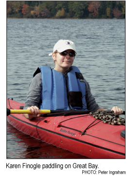
By Karen Finogle
[printer friendly page]
 It
could be a signal for Batman, but it’s day not night, and
we’re not in Gotham. Still, the form spiraling overhead
has the right symmetry. The small head tucked between two boomerang
wings set against a deep blue sky. The sleek, geometric angles
you could set a ruler against. With a wingspan of five feet or
more, it quickly dips down from the sky and crosses the water
not far from my kayak. I let the boat dance in the slow current
as I train my binoculars on the bird. It hovers over a wooden
post, like a plane turned stealth helicopter, twitching its body
and swooshing its wings in rapid fire before landing. It
could be a signal for Batman, but it’s day not night, and
we’re not in Gotham. Still, the form spiraling overhead
has the right symmetry. The small head tucked between two boomerang
wings set against a deep blue sky. The sleek, geometric angles
you could set a ruler against. With a wingspan of five feet or
more, it quickly dips down from the sky and crosses the water
not far from my kayak. I let the boat dance in the slow current
as I train my binoculars on the bird. It hovers over a wooden
post, like a plane turned stealth helicopter, twitching its body
and swooshing its wings in rapid fire before landing.
Such a sighting was once rare
in Great Bay, an estuary in southeastern New Hampshire. The osprey
was nearly wiped out in the 1950s and 1960s from DDT poisoning
in fish, the only food the raptors eat. There were less fish
too. Water pollution from sewage and industrialization dating
back to colonial times had soiled the nine square miles (23 square
kilometers) of the bay.
Now, at least a dozen pairs of
ospreys return to Great Bay each spring to hunt and raise a family.
It’s still a state-listed threatened species, but the osprey
has taken roost, and together we share water and habitat now
more pristine than any other estuary along the East Coast.
New Hampshire’s 18-mile
(29-kilometer) coastline is the shortest in the United States,
a mere afterthought as you head from Massachusetts to Maine.
But include the land that stretches back 10 miles (16 kilometers)
up the Piscataqua River and outlines Great Bay, and you have
about 150 miles (241 kilometers) of tidal shoreline that frames
one of the largest estuaries on the Atlantic Coast — an
ecological jewel that’s home to 162 bird, fish and plant
species and set in one of the fastest growing areas of the state.
I cap the binoculars and pick
up the paddle to push forward. My oars cut easily through the
placid water; the rumble of motorcycles, SUVs and cars on the
road near our put-in becomes muffled, then disappears. Framed
by five towns, Great Bay is a refuge from the normal hum of life.
Ahead, my partner Pete disrupts a gaggle of cormorants and gulls
gossiping and preening on the salt marsh banks, the only crowds
we’ll encounter today.
We had plunked our kayaks in
at the Squamscott River to paddle up the western shoreline of
Great Bay proper. There’s little wind, and it’s easy
to forget 98 percent of the water is saline, that the tides are
always pulling and pushing against this flooded depression, sunken
by the weight of glaciers thousands of years ago and then drowned
in ice-water engorged ocean. There is no crash of waves on the
shore, no sandy beaches. Meadows and woodland runs into salt
marsh that dance in the shallows, disturbed by only a smattering
of houses here and there.
The western shore is a quintessential
New England pastoral, one that you would expect to unfold on
a secluded lake. Then the oar flicks water on my face, and I
lick my lips. The saltiness is unmistakable. The pull of the
kayak forward, towards the sea, is celestial.
 Pete
and I live on the Oyster River, another tributary that flows
into Little Bay, just north of Great Bay proper. I saw my first
osprey from our dock. Heard the staccato-high “chirp, chirp,
chirp” of one as it called to its mate. Waited so patiently,
neck craned back, to see one bullet-dive for a fish and then
beat its giant wings to shed the weight of water and gravity
once more. I admired the freedom of their air current surfing,
their sense of ownership and singularity of purpose — their
wildness in an area that was tamed centuries ago. I have since
haunted the bay in my boat from our dock and other put-ins. Always
in search of their company, my eyes have become tuned to their
aerial frequency. Pete
and I live on the Oyster River, another tributary that flows
into Little Bay, just north of Great Bay proper. I saw my first
osprey from our dock. Heard the staccato-high “chirp, chirp,
chirp” of one as it called to its mate. Waited so patiently,
neck craned back, to see one bullet-dive for a fish and then
beat its giant wings to shed the weight of water and gravity
once more. I admired the freedom of their air current surfing,
their sense of ownership and singularity of purpose — their
wildness in an area that was tamed centuries ago. I have since
haunted the bay in my boat from our dock and other put-ins. Always
in search of their company, my eyes have become tuned to their
aerial frequency.
Fingers tingle from the figure
eight up-down, up-down of the two-hour, six-mile (9.6 kilometer)
paddle to Adam’s Point. This spigot of land marks the northern
terminus of Great Bay proper and is a place we frequently paddle
and drive to in order to walk the trails that weave along cliffs
and into meadows gone wild. I pull my kayak up onto the rocky
shoreline where water funnels quickly through Furber Strait.
Mud flats give way to wide rocks for seating. With cheese, bread
and hummus pulled from my boat’s hull, Pete and I settle
on a slab warmed by the sun to scan the skies above the 1,082-acre
(138-hectare) Great Bay National Wildlife Refuge on the opposite
shore.
We’ve finished lunch before
we see them. First one, then two figures dot the sky above the
refuge. Sailing on currents of air, they scan the waters below,
waiting for the afternoon sun to puncture the surface and reveal
the scales of elusive fish. I wait for the telltale signs —
the sleek wings that angle down into a pencil point. The flap-flap-glide
of the wing beat that distinguishes them from just another gull
on steroids. Two ospreys, their black stripe over their eyes
similar to a superhero’s mask, have arrived. The tide is
shifting and it’s nearly time for us to launch, but I wait.
I watch and wait until they shift course and drop back down behind
the tall pines in the refuge. The water tugs at the stern of
my boat, in an arm wrestle with the mud at the bow. We put in
to chase the current back.
Karen Finogle, a free-lance
writer and senior editor at AMC Outdoors, lives in Durham, New
Hampshire.
|